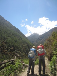
European epilogue

We left Kathmandu after two months in Nepal via Qatar Airways and the requisite layover in Doha, Qatar.  Landing at midnight in that hot, dry, modern, wealthy, sterile capital city for a 14 hour stay at the Doha Sheraton and Convention Center provided a bizarre interlude between our four months in Asia and our final three weeks in Europe.  We pushed the reset button while enjoying crisp, clean sheets and a bathtub overlooking the Persian Gulf.  The boys found Doha unusual, especially the modern architecture, but – as we were whisked back to the airport in our BMW sedan — lamented that we weren’t able to spend a little more time enjoying the luxury hotel facilities!
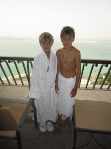
Enjoying the robe and slippers at the Sheraton, "wish we could stay longer", Doha, Qatar
Enjoying the robe and slippers at the Sheraton, “wish we could stay longer”, Doha, Qatar

Descending to land south of Rome on a clear, blue, spring day toward a runway surrounded by green fields and rolling hills exuding “Italian countryside”, we knew we’d left Asia and arrived on the final leg of our trip.  The sounds, the faces, the vehicles and infrastructure, the driving style, the food were all so distinctly non-Asian, but the most pronounced difference was the air quality.  For the first time on the trip (other than our rural trekking experiences) we felt like we could take a deep breath and it would be more likely to lengthen than to shorten our lives.  Clean air.  Don’t take it for granted.

Rome surprised with ancient objects around every corner: THE Pantheon, THE Colosseum, THE Forum, the mortal remains of THE Saint Paul, etc.  We spent several days roaming the city, gazing on the remnants of past glories, seeking out delectable pastries, meaty, cheesy sandwiches, strong coffee and cheap wine, and shopping for “affordable” clothing for our urban European travels.  (Mud spattered trekking pants and smoky, dusty down jackets are not currently in style in Rome.)  The inside knowledge of our consumate guide Andrew added to our appreciation of this city, and free lodging at his apartment kept our budget in check.  (Thanks Andrew and Maryann!)  In Rome we met up with many of the Annapolis Santins (Amy’s family) to explore the city, enjoy wine-soaked meals, and to celebrate a milestone birthday with Amy’s mom, Joan.

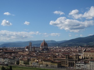
Our six days in Florence were spent moving from one stunning Renaissance art object to the next as we tried to make sense of the Medici family tree and brushed up on our bible stories (the subject matter of much of the painting of that era).  We wandered through piazza after piazza, from one palazzo to the next, from museo to galleria to ponte to giardino, always with our eyes out for the world’s best gelato (successful) and the perfect Florentine leather jackets (not successful).  Crossing the River Arno on the Ponte Vecchio (“vecchio” because it was the only bridge not destroyed by the Germans during their WWII retreat) we climbed to the Piazzale Michelangelo (site, the day before, of the Giro d’Italia stage 9 finish line) to gaze back over the city with Brunelleschi’s dome of the Basilica di Santa Maria del Fiore (or the Duomo) a prominent presence on the skyline.  Family favorites included some predictable ones — Botticelli’s paintings in the Uffizi and Michelangelo’s David — and some less predictable, such as the frescoes by Giotto in the chapels of the Basilica di Santa Croce.  (Also, there are a lot of famous dead people in Florence.  Santa Croce alone houses the remains of Michelangelo, Machiavelli and Galileo.)

Creepy street performer blessing the children in front of the Uffizi Museum, Florence, Italy
Florence on a blue sky day from Piazzale Michelangelo
Young mama on Old Bridge (Ponte Vecchio), Florence, Italy
Birthday girl: young mama on Old Bridge (Ponte Vecchio), Florence, Italy
Dante's statue in front of Santa Croce (mortal remains still in Ravenna?), Florence, Italy
Dante’s statue in front of Santa Croce (mortal remains still in Ravenna?), Florence, Italy
Braxton trying to understand what the Last Judgment has in store for him, The Duomo, Florence

Longing for some exercise (other than walking the streets eating gelato and cheese), we hopped a train to the walled city of Viterbo and took a bus onward to the medieval hilltop town of Montefiascone for a day hike along the via Francigena.  This ancient pilgrimage route from France to Rome runs along the via Cassi established by one Cassius or another in the last centuries BC, and some sections of the Roman road are still intact.  The weather held and we wrapped our last full day in Italy with a late-night, local train ride back to Rome.
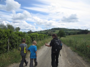
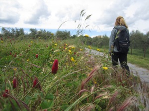
On the via Francigena to Viterbo, Italy
Pilgrimage among olives and flowers on 2000 year old road, between Montefiascone and Viterbo, Italy
Swinging above the Cattedrale di Santa Margherita, Montefiascone, Italy

A quick two days in Paris was not enough to scratch the surface of the City of Lights, but we did manage a walk that took us to the Ile de la Cite, birthplace of Paris and home to the Notre-Dame Cathedral.  The boys, having had enough of European churches, took greater delight in a two-person, bouncy ride in the playground next to the cathedral than in the flying buttresses of the Gothic apse.  A stroll along the left bank of the Seine took us to the fabulous Musee d’Orsay housing a great collection of impressionist works, including many a Monet, Cezanne, Degas, Pissaro, Sisley and Renoir.  As always, the audio tour was worth the price, and we left knowing more about painting in 1870s France than we ever thought we’d care to know.  The Paris highlight was dinner in Versailles with the Froidvaux family.  Amy and her four siblings had hosted the four Froidvaux children (and vice versa) in the 1970s and 1980s.  This boisterous reunion was the first in nearly 30 years (made possible by Facebook).  As in Rome, the budget remained more or less intact thanks to the generosity of a friend.  (Thanks, Kate, for the great apartment!)

Rocking in the shadows of Notre-Dame Cathedral, Paris
High water on the Seine, Paris

An early morning cab ride to Charles de Gaulle and we were off on our final leg of the journey: to Iceland.  Why the not so obvious Iceland?  Simple.  Iceland Air had the cheapest fares from Europe to the US when we were looking for our return tickets and offered free layovers for up to seven days.  And what better place to put the final exclamation point on our world tour?  Iceland didn’t disappoint.

What to say about this strange place of only 320,000 hardy souls?  Hovering just south of the Arctic Circle, Iceland is very far north.  So, this time of year it is light out nearly 24 hours per day making it difficult to sleep even on the world’s most comfortable beds (which Iceland has).  Two-thirds of Icelanders live in the capital city of Reykjavik, so most of Iceland is rural with only sparse human habitation.  Trolls, which were commonplace at the time of European settlement in the 9th Century AD, are now endangered and possibly even extinct.

Rural Iceland from the road
On gravel ten minutes outside Reykjavik, Iceland

Iceland is essentially a volcano rising out of the North Atlantic, but it is a volcano covered with ice.  (Actually it is a lot of volcanoes covered with ice.  Each aircraft in the Iceland Air fleet is named after a different Icelandic volcano.)  This is a strange combination which leads to beautiful, stark scenery and serious natural disasters.  When a volcano erupts under a glacier, the ice melts.  The unstoppable torrents of water and ash, known as jokulhlaups, running off toward the sea are what cause most of the destruction in these events, wiping out bridges and roads and turning vast expanses of farmland into mud flats.
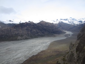
The muddy aftermath of a jokulhhaup, Skaftafell National Park
The muddy aftermath of a jokulhlaup, Skaftafell National Park

We managed to avoid the jokulhlaups and to enjoy the scenic beauty as we cruised the southern part of the island in our rented car.  Mostly overcast, we didn’t see the tops of many of the volcanoes, but were able to imagine them looming behind the clouds.  We also had to imagine the bulk of massive Vatnajokull, Europe’s largest glacier, and be satisfied with seeing just the fingers of this monster (each with its own unpronounceable Icelandic name) as they crept down from the mountain valleys to calve into melt water lagoons.  At the head of Breidamerkurjokull, the blue water of Jokulsarlon (Glacier Lagoon) — which has made cameo appearances in two James Bond films, Tomb Raider, and Batman Begins — clashed with the grey sea churning in through a tight channel at high tide.  Gazing down from a 1000 meter high promontory onto the scarred and pitted surface of another finger, Skaftafellsjokull, it was difficult to appreciate the scale of even this small portion of the ice sheet.  But the periodic booming crashes of ice falling off Morsarjokull as it reached its final precipice were a reminder of the size and power of these slowly diminishing natural phenomena.

Say what? Skaftafell National Park, Iceland
Overlooking Skaftafellsjokull, Iceland
Family shot at Glacier Lagoon, Iceland
Iceland is dangerous!
Iceland is windy!
Iceland is windy!
Iceland is snowy!
Iceland is snowy!
Iceland is for lovers!

Returning to civilization via the best bowl of lobster soup ever tasted by humankind, we rolled into Reykjavik for our final night of the trip.  With so much to choose from in Reykjavik and so little time, we opted to visit the Icelandic Phallological Museum.  (Yes, it is what it sounds like it is, and, yes, Amy decided to skip this one.)

The next day, our last day in Europe, was spent soaking in the geothermal sulfur hot springs of the Blue Lagoon outside Grindavik.  Steam baths, saunas, silica mud facials, a huge steaming natural hot spring, and a cold beer (or blue “raspberry” slushy depending on age) were a great way to unwind before jumping our flight back into the eastern time zone of the United States.

Beauty treatment, Blue Lagoon, Iceland
Birthday boy: age-defying algae mask and cold beer, Blue Lagoon, Iceland

Trekking the Manaslu Circuit

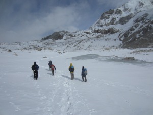
The name of the game on the Manaslu Circuit is acclimatization: getting your flatlander body conditioned to survive in the low-oxygen environs at the top of 5160m Larke La pass.  Staying healthy, uninjured, warm and dry also count for a lot.  After leaving the Tsum Valley we started a six day climb along the Budhi Gandaki from 1800m to 4460m at Larke Phedi with the pass, and the dangers associated with it, always in mind.

Up we went, counter-clockwise around the Manaslu Himal with the towering centerpiece, Mt. Manaslu (at 8163m the 8th highest and 4th most deadly mountain in the world), and Manaslu North (7157m) often visible to our left and a variety of lesser peaks on all sides.  In order to start pushing our bodies’ limits and to avoid sleep-induced respiratory problems, we hiked high during the day and slept low at night.
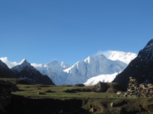
Manaslu from Samagaon
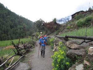
Competing with donkey trains on narrow paths, Manaslu Circuit
Father and son carrying fodder for the livestock, Manaslu Circuit
Strange man with trekking poles and high-end rain gear, Manaslu Circuit
Up we go
Up we go
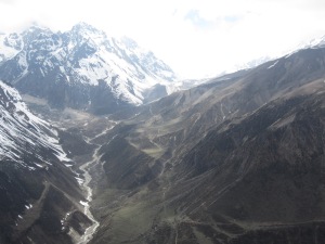
Following the Budhi Gandaki on ancient footpaths, Manaslu Circuit
Water-powered corn mill, below Bihi Phedi
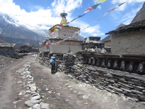
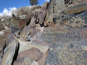
Buddha images begin to appear on the mani walls, Manaslu Circuit
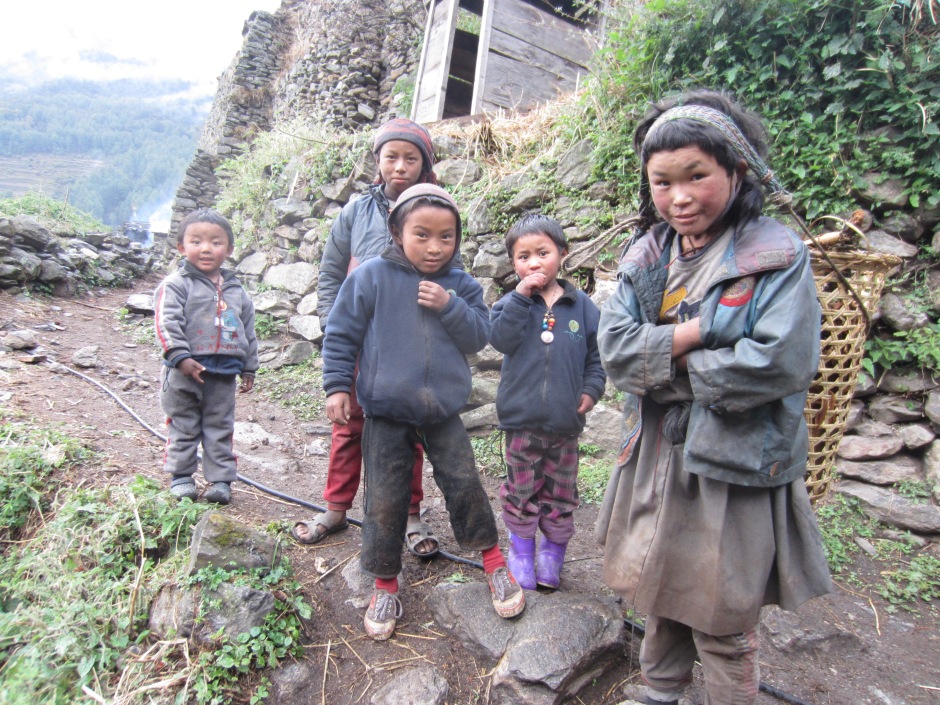
Braxton and the children of Lihi
Strolling through the village of Sho
Rolling into the village of Lho
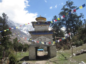
Village gate, Shyala
Ceiling of village gate, Shyala
Digging potatoes out of their winter storage pit, Samagaon
Yak team plowing fields for the next potato crop, Samagaon
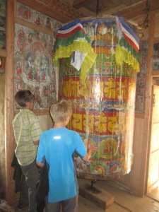
Braxton turning the dharma wheels, Samagaon

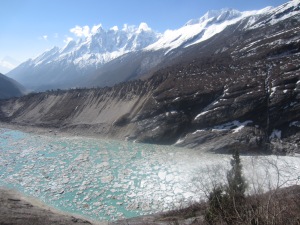
During a rest day in Samagaon (3520m) we hiked along the Manaslu Glacier to 4200m on the Manaslu basecamp trail.  As we rested at our high point we listened and watched as pieces of the glacier broke apart to plummet down toward the turquoise blue Birendra Tal below.  The sound of a groaning, cracking glacier as it warmed in the eastern morning sun was only surpassed by the booming crash of these periodic avalanches.
Overlooking Birendra Tal, Samagaon
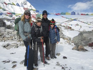
Jaya (our guide) and the boys, Manaslu Glacier
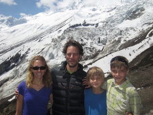
Family shot, Manaslu Glacier

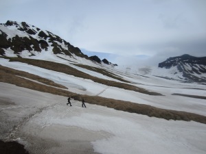
The next day, after reaching Samdo (3875m), we hiked straight up the nearby hill through low-lying, fragrant juniper to an altitude of 4500m.  As was the case on most days, clouds started to roll in and the wind picked up significantly by the early afternoon whipping the ubiquitous prayer flags into a frenzy.  Before climbing down we were able to get our first glimpse of the pass, a formidable jumble of loose rock and drifted snow in a landscape formed by glaciers long ago.

Team with the children of Samdo
Day hike turns windy, above Samdo
A first look at the pass, from above Samdo
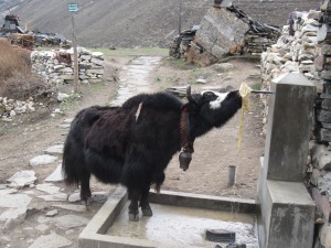
Public fountain, Samdo

The last stop before the pass was the stone huts of Larke Phedi, an outpost with no other purpose than as a launch pad for crossing Larke La.  The afternoon in Larke Phedi was spent with another steep climb, this time to 4800m.  The views to the pass were partially obscured by cloud and mist adding to the ominous sense that we were heading into a place where mistakes could be quite costly.  That evening Braxton was stricken with a bout of food poisoning and the next day’s pass attempt looked uncertain.  Nonetheless, we set the alarms for 3:30am, and, Braxton having miraculously recovered, awoke from fitful sleeps to pack, sip some tea, gag down a chapati and boiled egg and head into the pre-dawn darkness on a slow but steady pace toward Larke La.

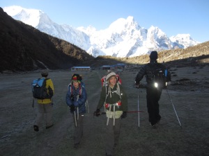
A beautiful morning hike to Larke Phedi
Old stones, on the way to Larke Phedi
More old stones as browns start to enter the slate color palette, on the way to Larke Phedi
Mother and sons with Manaslu North looming in background
Pulling in to Larke Phedi
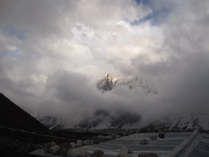
Mountains come out of the sky above the roofs of Larke Phedi on a cold, cloudy afternoon

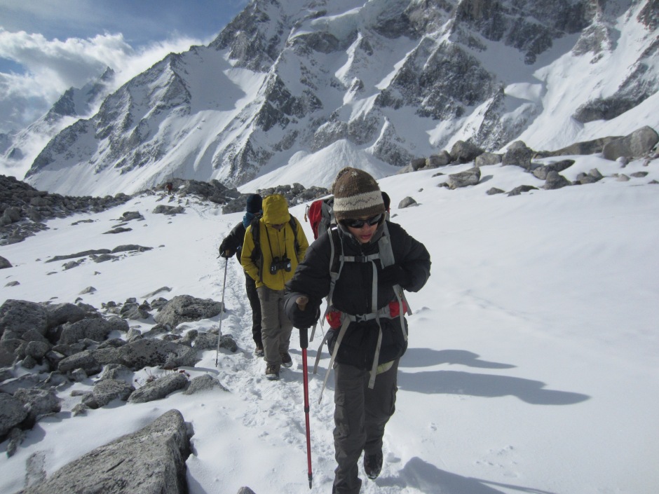
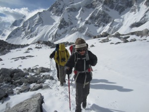
Within three hours we’d reached the pass and by 8:15am, having taken the requisite photos, we started a treacherous descent down the west side.  Ice-covered rocks, drifted snow, and loose gravel contributed to many a stumble mostly landing on our backsides and none of them serious.  We avoided turning ankles or breaking bones during the four hour downhill run and pulled into Bimthang (3590m) just after noon ready for a hot meal and our first hot shower in over a week.

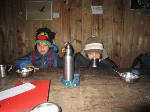
4:00am breakfast on pass day, Larke Phedi
Approaching the pass, below Larke La
Getting closer, below Larke La
Not another family shot?!?! Yes, the obligatory group photo atop Larke La
Braxton with rasta monkey hat, Larke La
Henry triumphant, Larke La
Jaya and Tara, Larke La
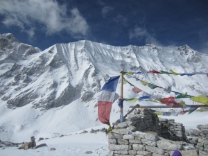
Prayer flags and white mountains, Larke La

The final day of walking took us on a relatively gradual descent through stunning forest scenery to the trail head at Dharapani from which we made our way by road back to Kathmandu the next day.

Setting out from Bimthang on our last day of trekking
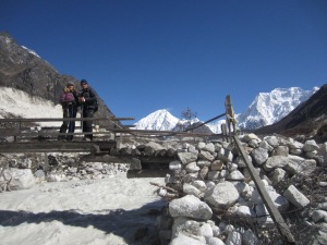
Rickety bridge over the Dood Khola (Milk River)
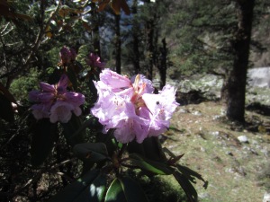
Eight shades of rhododendron
Some of the eight shades of rhododendron, below Bimthang

IMG_2458IMG_2459IMG_2465

Yellow flowers, below Bimthang

IMG_2462IMG_2457IMG_2297

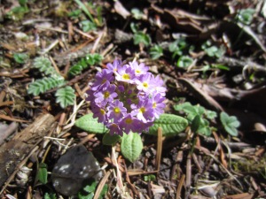
Purple flowers, below Bimthang

IMG_2475

Strange flowers, below Bimthang
One mistake, game over.  Jeep road from Dharapani to Besisahar
“One mistake, game over” jeep road from Dharapani to Besi Sahar

Crossing Larke La — a literal high point in the trip — gave us a sense of accomplishment and satisfaction, but it was, at the same time, anti-climactic and felt like a milestone marking the final stages of the trip we’ve been on since mid-January.  Oddly, the ease with which we crossed the pass was almost disappointing: the much-feared disasters did not materialize and no stories of derring-do or perseverance in the face of tough odds emerged from the experience.  Yes, thankfully!  But the notion that the trip would be all downhill from here (back to the flush toilets and varied menu of Kathmandu, back to the wired world, back towards home via the clean, organized countries of Europe, back to our own beds, a car, a refrigerator) brought with it a feeling of loss; specifically, the loss of a sense of adventure that comes with entering the unknown.

Resigned to the fact that now we are heading toward the known, we are really looking forward to getting there!

Safe arrival in Besi Sahar

(We should add that a guide is required for the Manaslu Circuit, and we were accompanied by a great one, Jaya Bhandari, and a strong porter, Tara.  These guys were a tremendous help and the trip would not have been as successful or enjoyable without them.  They were both great with the boys.  Jaya is also a naturalist, birder, yoga instructor, and reiki healer, all of which came in handy throughout the trek.  If you are considering a trek in Nepal, get in touch with these guys through http://www.thirdpoletreks.com or directly with Jaya at bjayan24@hotmail.com)

Tsum Valley

We spent five days hiking into the remote Tsum Valley as part of our larger trek around the Manaslu Circuit.

The Tsum Valley runs through a protrusion of Nepalese territory surrounded by Tibet on three sides and nestled among peaks topping 7400m, including the massive Ganesh Himal to the south and east.  The Tibetan border is within 10km from all parts of the Tsum, but is only accessible via 5000m passes at the northeastern end of valley.  The southwestern entrance to the valley is through a narrow gorge at the confluence of the Budhi Gandaki and the Siyar Khola.  The misty weather on the day we entered, the moss draped trees, and the quiet walking path cushioned with pine needles all added to the sense that this was a secret place that time, so far, has forgotten.

Entering the Tsum Valley
Climbing into the Lower Tsum Valley on a rainy day with the Siyar Khola far below
A last steep climb into Chumling past a mani wall, Lower Tsum Valley

The Tsum Valley trek follows an out-and-back route that does not fit in to most trekkers’ schedules, and it has only been open to non-Nepalis for a few years.  As a result, the valley is relatively untouched by the trekking economy and culture; accommodation and food are very basic and the daily lives of the people in the valley revolve around the activities they’ve revolved around for hundreds of years.  This is in stark contrast to Langtang (reported on in an earlier post) or the Annapurna area (which Amy and I visited in the 1990s), both of which have been so overrun by trekkers that it is difficult to find any remnants of the pre-trekking cultures.  Perhaps the inconvenient remoteness (it takes a half day hair-raising bus ride, a half day bone-crunching jeep ride, and three days of walking to get to the entrance of the valley) and expense (permits and guides required) will help preserve the valley in its current state, but I wouldn’t bet on it.  Get there now.
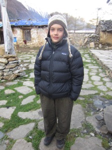
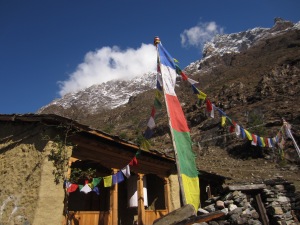
In order to picture the Tsum Valley, imagine your most idyllic vision of Tibet: a high-altitude, wide valley of fields demarcated from by stone walls, a bright green, early wheat crop in the ground, dirt footpaths running through medieval villages, surrounded by soaring white peaks in all directions with a sometimes meandering, sometimes plunging river running through it.  Add all of the religious symbols of the Buddhist culture: the carved stones along the mani walls to remember those who’ve passed, the periodic stupa and chorten, and the ever present blue, white, red, green and yellow pray flags.  Add gaggles of children with cheeks so sun- and wind-burned that they bleed, their faces caked with dirt and snot but still full of energy and excitement as they march to school or chase livestock with a stick.  Remove the several decades of Chinese occupation and infrastructure development that have occurred just over the border and you will begin to envision this place.
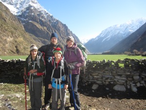
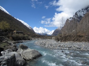
Chorten up-valley from Burji, Upper Tsum Valley

IMG_2212IMG_2211IMG_2281

Water-powered prayer wheel unceasingly sending oms out to the universe, Lower Tsum Valley
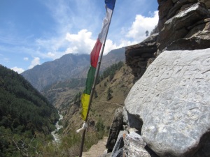
Carved stone on mani wall, prayer flag, and trail far below, reentering the Lower Tsum Valley
A cluster of buildings in wheat fields, Lower Tsum Valley
Hiking in on an overcast day, between upper and lower valley
Hiking out in the sun
Small village with village gate in foreground, Upper Tsum Valley
Huge dharma wheel next to Milarepa's cave, Burji
Huge dharma wheel next to Milarepa’s cave, Burji
Milarepa, Tibet's famous yogi and poet turned green after eating nothing but nettles, Burji
Milarepa, Tibet’s famous yogi and poet turned green after eating nothing but nettles, Burji
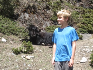
A big yak, on the way to Mu Gompa
Children of Chumling, Lower Tsum Valley
On the way to school, Upper Tsum Valley
Big book bags, on the way to Mu Gompa
The guns have been silenced, but the sentiments of the civil war remain ("Long Live Himali Bhote Lama Liberation Front"), Chumling
The guns have been silenced, but the sentiments of the civil war remain (“Long Live Himali Bhote Lama Liberation Front”), Chumling

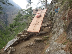
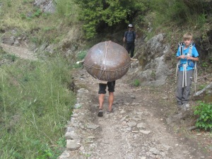
In order to imagine the basic level at which life is led in the Tsum, imagine a place where cow and yak dung are valuable commodities collected for fertilizer, but also for fuel.  Pack animals and people carry anything that enters or leaves the valley.  There are no motorized vehicles, no power tools, no cell phone signal, no stores (beyond the Chumling general store), no indoor plumbing.  We spent one long day hiking between meals in search of a pack of crackers or other snack to no avail.  There was no food for sale in this super rural and isolated place.  Electric power, if available, comes from small household photovoltaic panels (enough to power several compact florescent bulbs and to recharge batteries) or micro hydro generators.  The latter produce enough electricity to light a village or two, but only if they are functioning.  In Burji, for example, the electric wires were strung and connected, but there was no power.  Apparently the generator had failed, and, without a local technician to deal with the repair, they dismantled the unit and carried it back to Kathmandu for servicing.

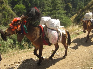
Decorated donkey with full load, Tsum Valley
How plywood gets to the Tsum Valley
How huge steel cook pots get to the Tsum Valley
Braxton and a wall full of yak dung fuel, Burji

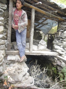
For three of our four nights in the Tsum we stayed in unconventional accommodation (ie, not a teahouse or lodge built to house trekkers).  In the small village of Chumling we found shelter in tiny rooms above the Chumling general store.  Happy to be out of the rain that had plagued us in the early days of the trek, we ate what was served while squeezed in front of the store counter looking at the wide variety of goods for sale.  Alcohol and cigarettes dominated the selection, but shoes, biscuits, bulk salt and sugar, soap, a few cell phones (to be used we don’t know where), and other strange items like vacuum packed ‘Instant Spicy Fish’ were also on offer.  Many of these goods had come down the trail from nearby Tibet.  Pirated timber moves in the opposite direction from the lower valley up across the border.

Chumling general store, Lower Tsum Valley
Breakfast remains with store owner's daughter guarding the goods, Chumling, Lower Tsum Valley
Breakfast remains with store owner’s daughter guarding the goods, Chumling, Lower Tsum Valley
Watch your head, typical bedroom door, Chumling
Typical Tsum Valley kitchen, Chumling
An afternoon read with milk tea, Chumling

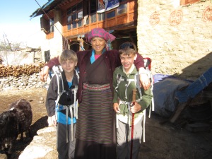
Our second night, in the Upper Tsum Valley village of Chekompa, was spent in a Tibetan family’s homestay.  We slept above the stable under a loosely slated roof and draped plastic tarps that did not prove to be 100% waterproof when tested by a midnight shower.  We’d spent most of that day hiking steeply uphill from the lower to the upper section of the valley and slept pretty well despite the drips.

Our hostess in Chekompa
Leaving Chekompa
Leaving Chekompa

IMG_2179

Our third night, in the even smaller village of Burji, we stayed in a newly-opened lodge with a legitimate roof and a sign advertising 24 hour hot showers.  The leak-proof roof provided a comfortable night’s sleep.  The hot showers proved to be aspirational, perhaps to be realized at some future date when the proprietor invests in solar panels or a gas canister hook up.

We spent the fourth day hiking from Burji up to Mu Gompa, a monastery perched on a wind swept promontory at 3700m.  This barren place houses a group of young monks who cooked up bowls of instant noodles and cups of steaming butter tea, the only food within miles.  Several kilometers distant and over 1500m higher one could access the passes into Tibet.  We met a group of young men who were hiking into this high area to spend several months gathering plants used in Tibetan medicine.  They anticipated that Chinese merchants would come across the border to buy their harvest before the end of the season.

Boys on the way to Mu Gompa
An uphill kicker at the end of a long hike, Mu Gompa
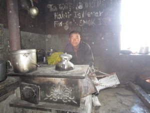
A monk and his cooking stove, Mu Gompa
Braxton in the kitchen door, Mu Gompa
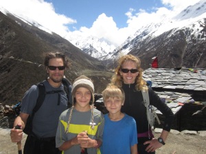
Posing for the group photo, Mu Gompa
Posing for one of many group photos, Mu Gompa
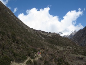
The view down valley from Mu Gompa

Our fourth and final night in the valley was spent in the Rachen Gompa nunnery where the nuns had indeed managed not one but two solar hot water systems, one for the nuns and one for the faculty.  The trickle of hot water on a cold evening at over 3200m felt like heaven.  Even closer to heaven (or at least more closely related to the topic) was our observation of an early morning puja in the central monastery.  Rising at 5:30am we followed our ears to the daily breakfast-n-prayer ceremony where 50+ crimson-robed, shaved-headed nuns ranging in age from teenaged girls to wizened elders sat cross legged in rows chanting, drumming, blowing horns and conch shells in an orchestrated cacophony, intermittently sipping salty butter tea and eating from bowls of dry tsampa porridge.  We sat, watched and listened, sipping our own butter tea.  With our eyes closed we could begin to hear the patterns emerging from the chanting, which started to feel less confused and more powerful as we leaned against the brightly painted plaster walls in the centuries old temple in the middle of nowhere.

Henry in the yard of Rachen Gompa, Upper Tsum Valley

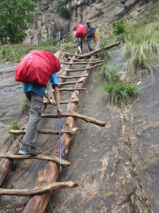
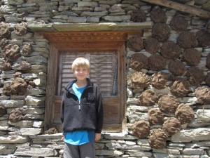
We felt a deep sense of awe, but also of sadness, hiking out of the Upper Tsum Valley on our fifth day.  Down we went on this sunny but chilly morning passing through all of the villages and fields we’d passed during our ascent.  Down narrow, steep stairs cut into the sides of cliffs with precipitous drops and certain death by falling on one side and the threat of crushing rocks falling from above on the other.  Past the mani walls, across the suspension bridges, along the dirt paths between mud plastered stone houses, walls piled high with firewood gathered over the year and pasted with hand-patted dung patties drying in the sun, to emerge from the valley by the end of a long day and reenter the flow of human and animal traffic climbing through the Nubri Valley of the Manaslu Circuit.

Leaving Rachen Gompa
A river runs through it, upper reaches of the Siyar Khola

IMG_2282

Boys hiking out on a sunny day, entering Lower Tsum Valley