European epilogue

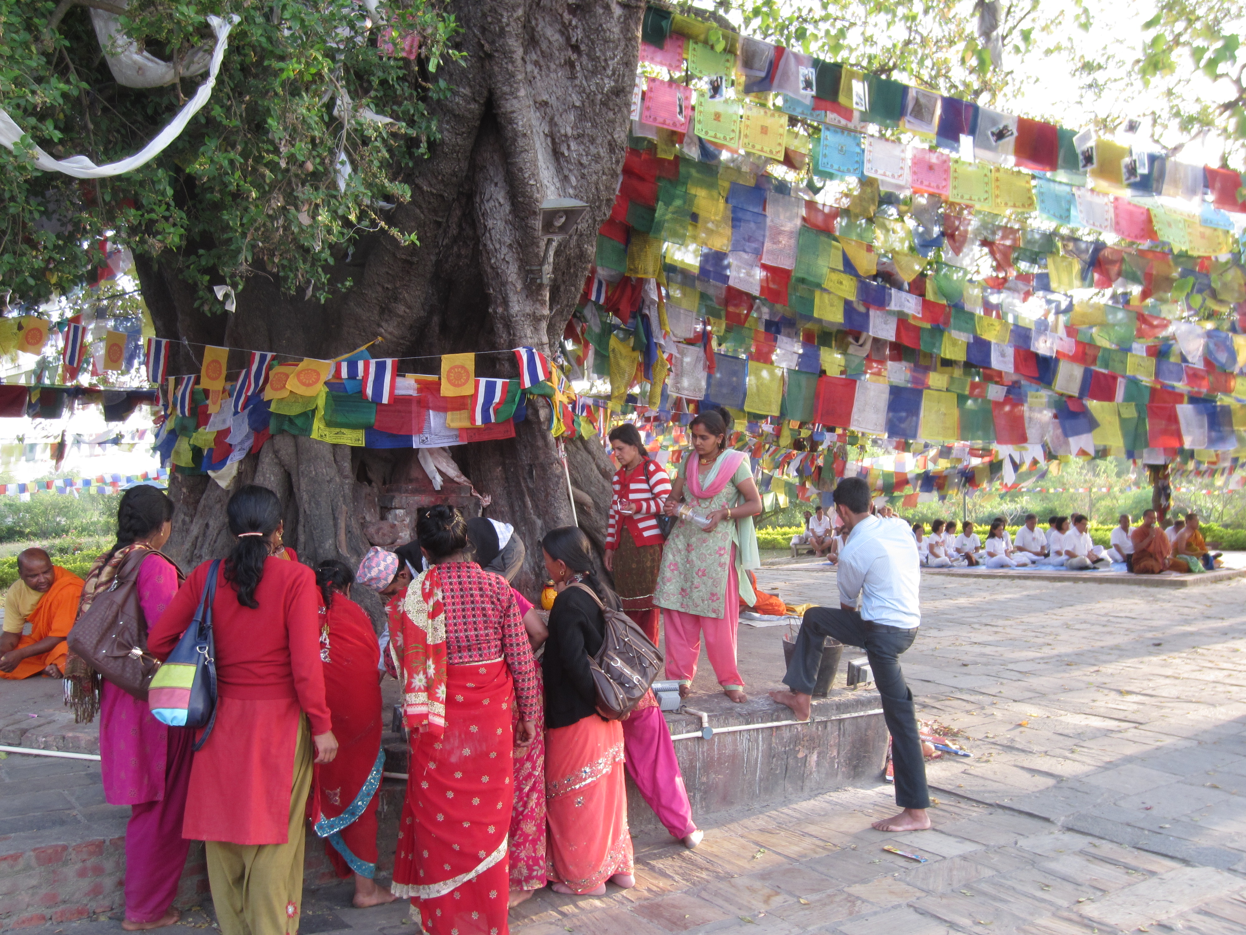
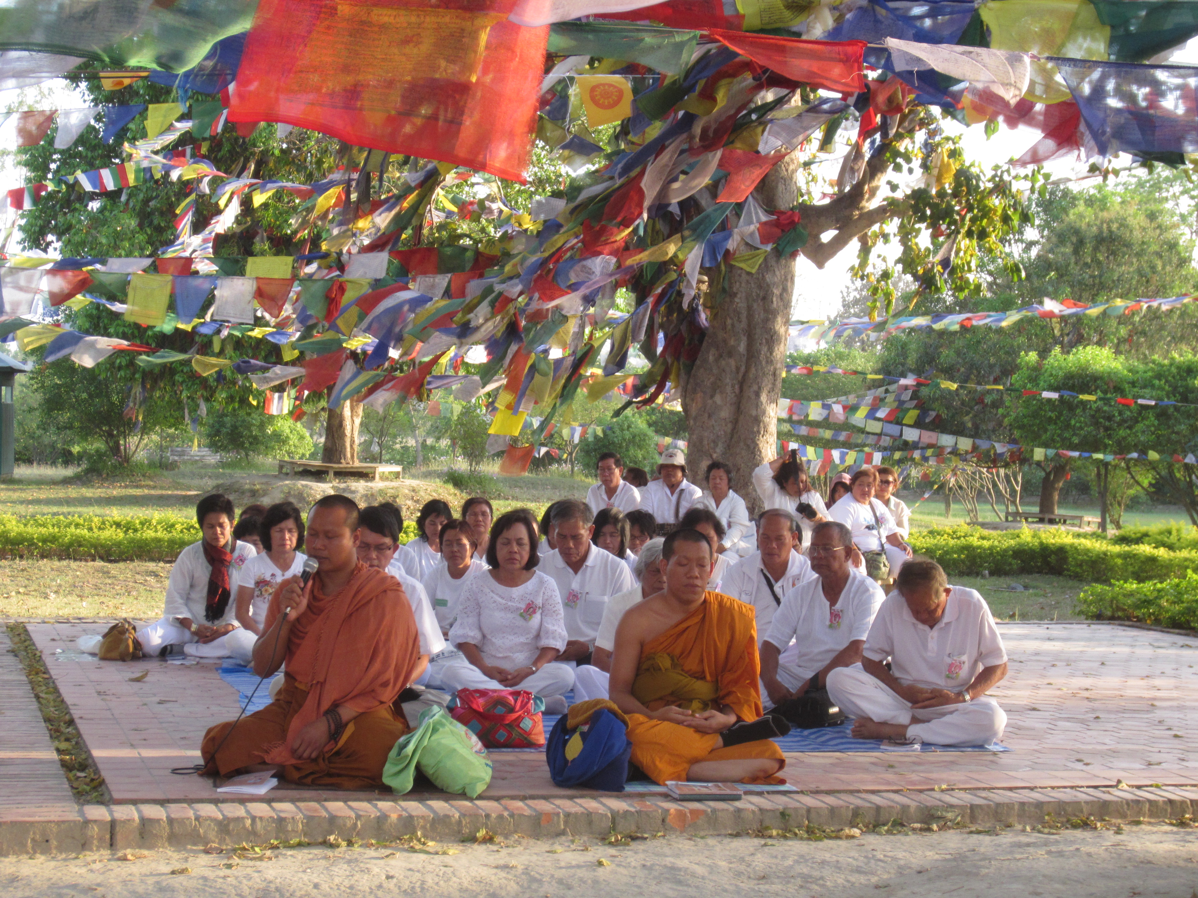
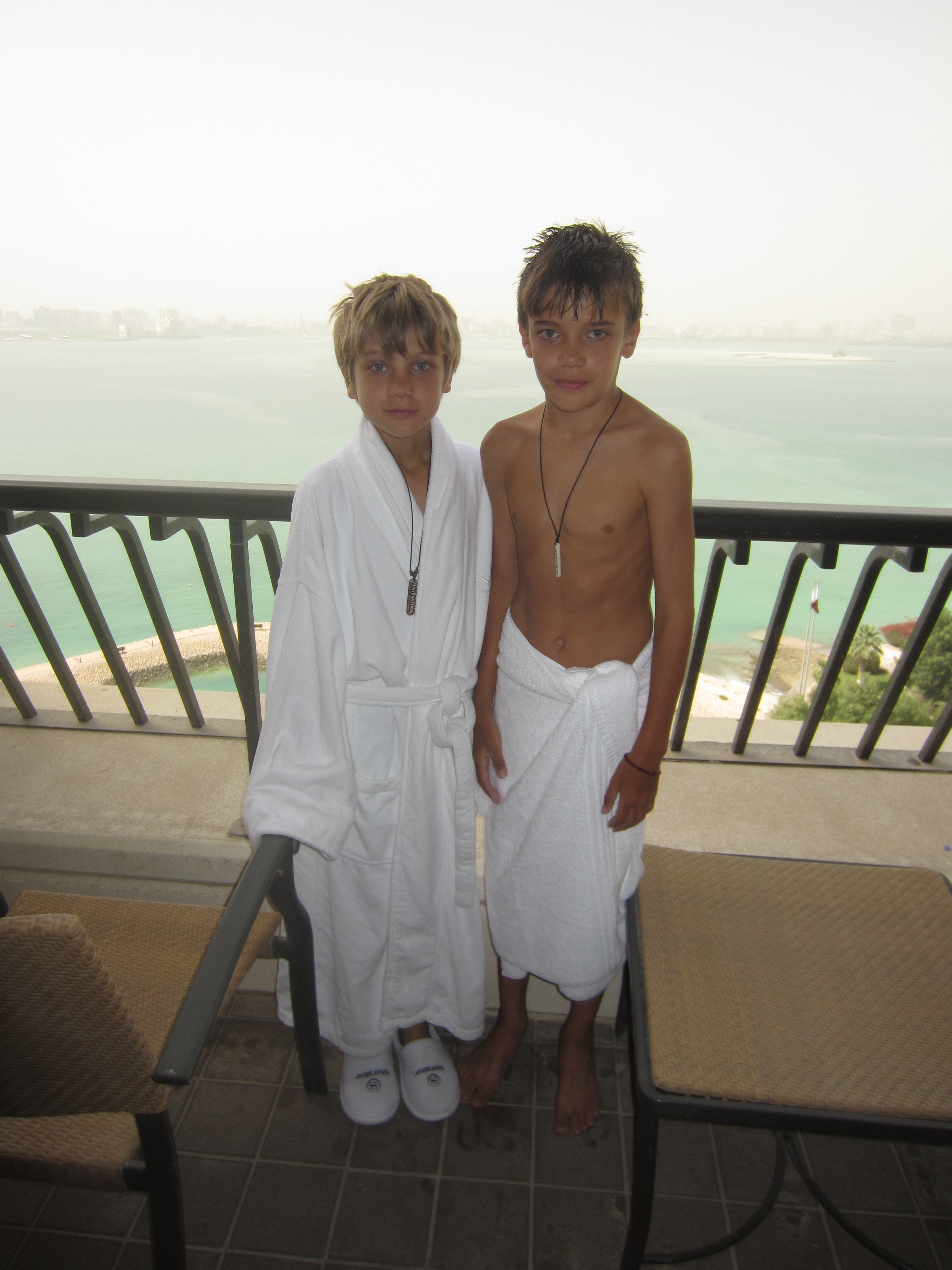
We left Kathmandu after two months in Nepal via Qatar Airways and the requisite layover in Doha, Qatar.  Landing at midnight in that hot, dry, modern, wealthy, sterile capital city for a 14 hour stay at the Doha Sheraton and Convention Center provided a bizarre interlude between our four months in Asia and our final three weeks in Europe.  We pushed the reset button while enjoying crisp, clean sheets and a bathtub overlooking the Persian Gulf.  The boys found Doha unusual, especially the modern architecture, but – as we were whisked back to the airport in our BMW sedan — lamented that we weren’t able to spend a little more time enjoying the luxury hotel facilities!

Enjoying the robe and slippers at the Sheraton, "wish we could stay longer", Doha, Qatar
Enjoying the robe and slippers at the Sheraton, “wish we could stay longer”, Doha, Qatar

Descending to land south of Rome on a clear, blue, spring day toward a runway surrounded by green fields and rolling hills exuding “Italian countryside”, we knew we’d left Asia and arrived on the final leg of our trip.  The sounds, the faces, the vehicles and infrastructure, the driving style, the food were all so distinctly non-Asian, but the most pronounced difference was the air quality.  For the first time on the trip (other than our rural trekking experiences) we felt like we could take a deep breath and it would be more likely to lengthen than to shorten our lives.  Clean air.  Don’t take it for granted.

Rome surprised with ancient objects around every corner: THE Pantheon, THE Colosseum, THE Forum, the mortal remains of THE Saint Paul, etc.  We spent several days roaming the city, gazing on the remnants of past glories, seeking out delectable pastries, meaty, cheesy sandwiches, strong coffee and cheap wine, and shopping for “affordable” clothing for our urban European travels.  (Mud spattered trekking pants and smoky, dusty down jackets are not currently in style in Rome.)  The inside knowledge of our consumate guide Andrew added to our appreciation of this city, and free lodging at his apartment kept our budget in check.  (Thanks Andrew and Maryann!)  In Rome we met up with many of the Annapolis Santins (Amy’s family) to explore the city, enjoy wine-soaked meals, and to celebrate a milestone birthday with Amy’s mom, Joan.

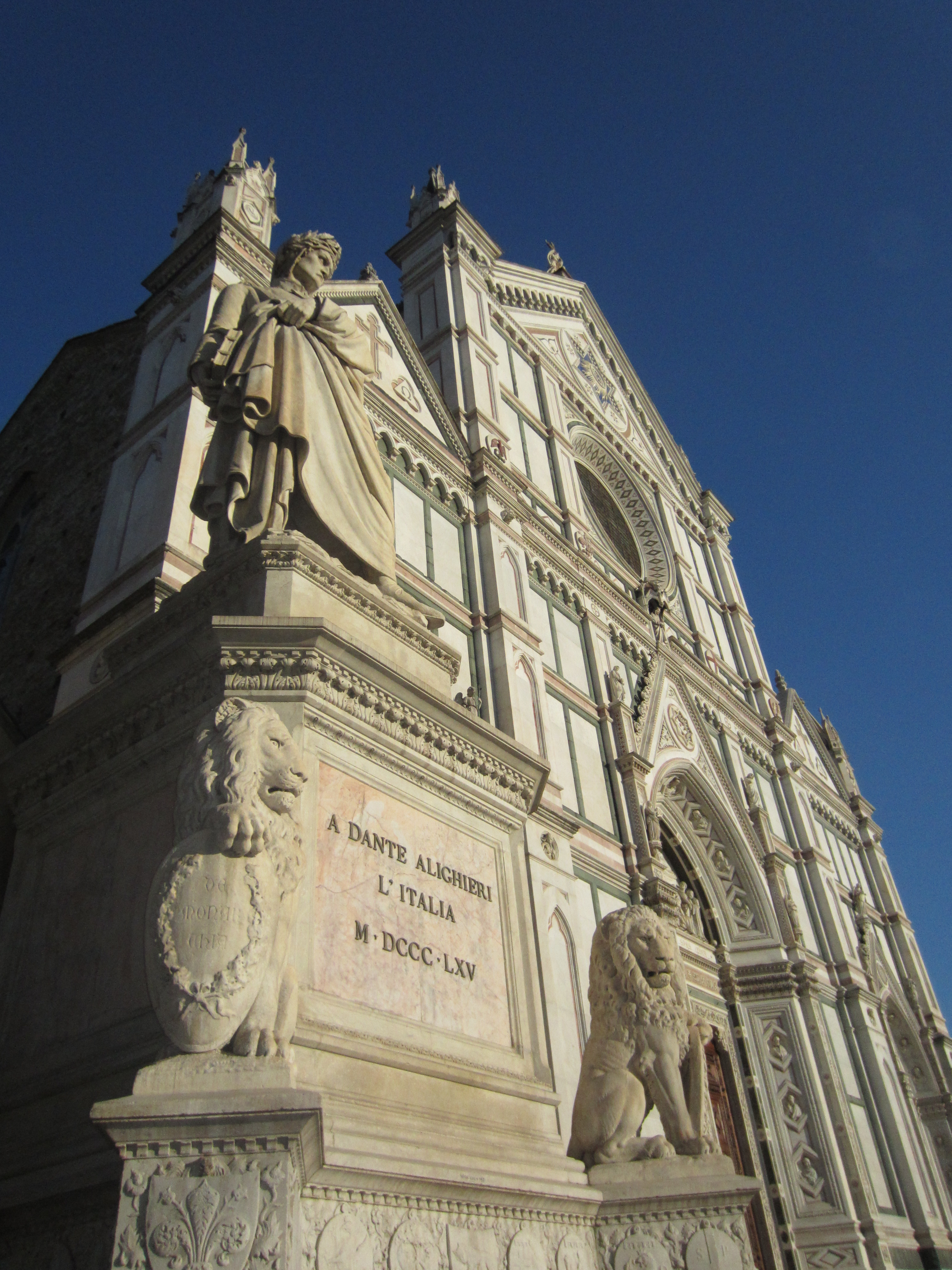
Our six days in Florence were spent moving from one stunning Renaissance art object to the next as we tried to make sense of the Medici family tree and brushed up on our bible stories (the subject matter of much of the painting of that era).  We wandered through piazza after piazza, from one palazzo to the next, from museo to galleria to ponte to giardino, always with our eyes out for the world’s best gelato (successful) and the perfect Florentine leather jackets (not successful).  Crossing the River Arno on the Ponte Vecchio (“vecchio” because it was the only bridge not destroyed by the Germans during their WWII retreat) we climbed to the Piazzale Michelangelo (site, the day before, of the Giro d’Italia stage 9 finish line) to gaze back over the city with Brunelleschi’s dome of the Basilica di Santa Maria del Fiore (or the Duomo) a prominent presence on the skyline.  Family favorites included some predictable ones — Botticelli’s paintings in the Uffizi and Michelangelo’s David — and some less predictable, such as the frescoes by Giotto in the chapels of the Basilica di Santa Croce.  (Also, there are a lot of famous dead people in Florence.  Santa Croce alone houses the remains of Michelangelo, Machiavelli and Galileo.)

Creepy street performer blessing the children in front of the Uffizi Museum, Florence, Italy
Florence on a blue sky day from Piazzale Michelangelo
Young mama on Old Bridge (Ponte Vecchio), Florence, Italy
Birthday girl: young mama on Old Bridge (Ponte Vecchio), Florence, Italy
Dante's statue in front of Santa Croce (mortal remains still in Ravenna?), Florence, Italy
Dante’s statue in front of Santa Croce (mortal remains still in Ravenna?), Florence, Italy
Braxton trying to understand what the Last Judgment has in store for him, The Duomo, Florence

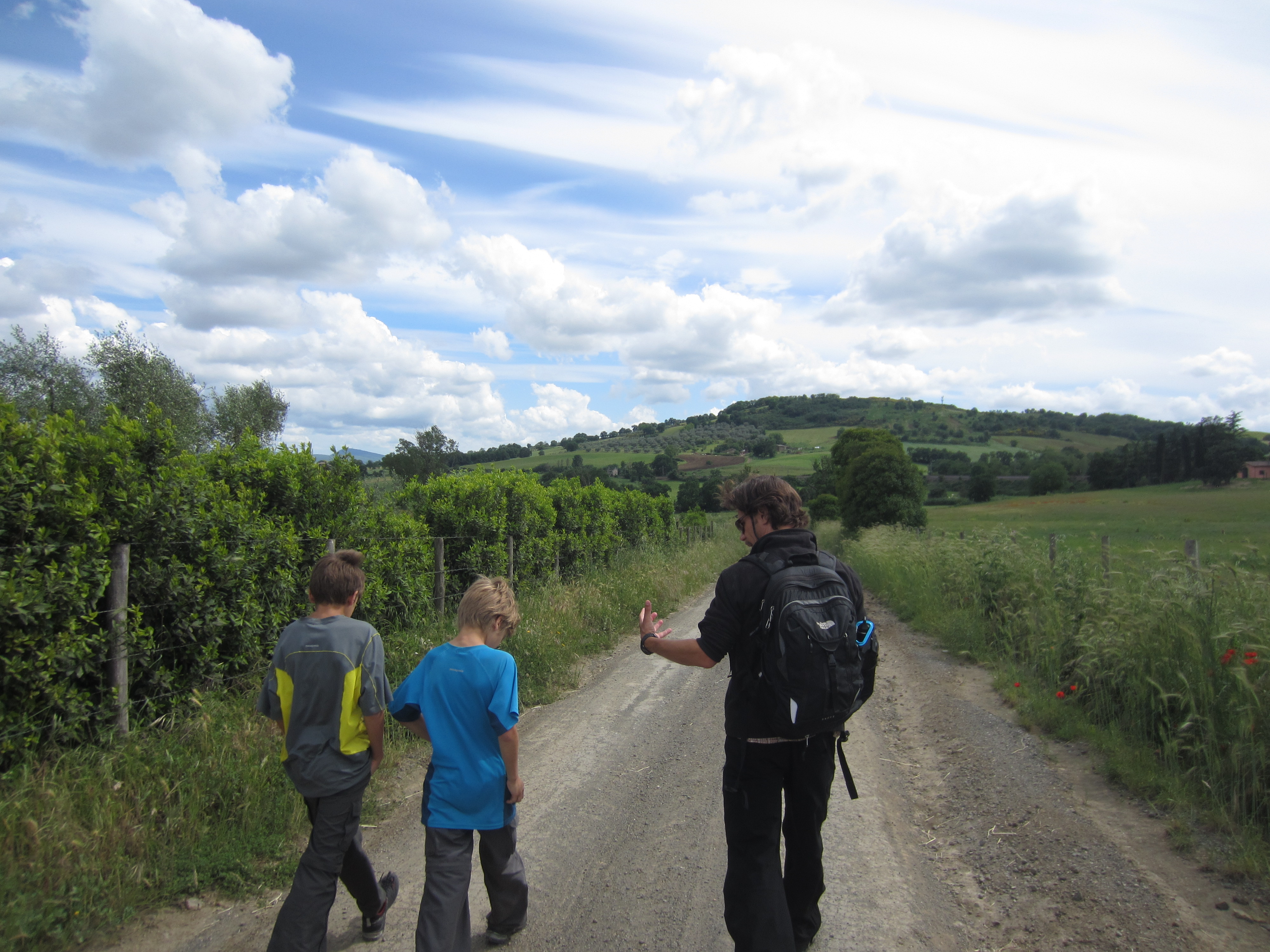
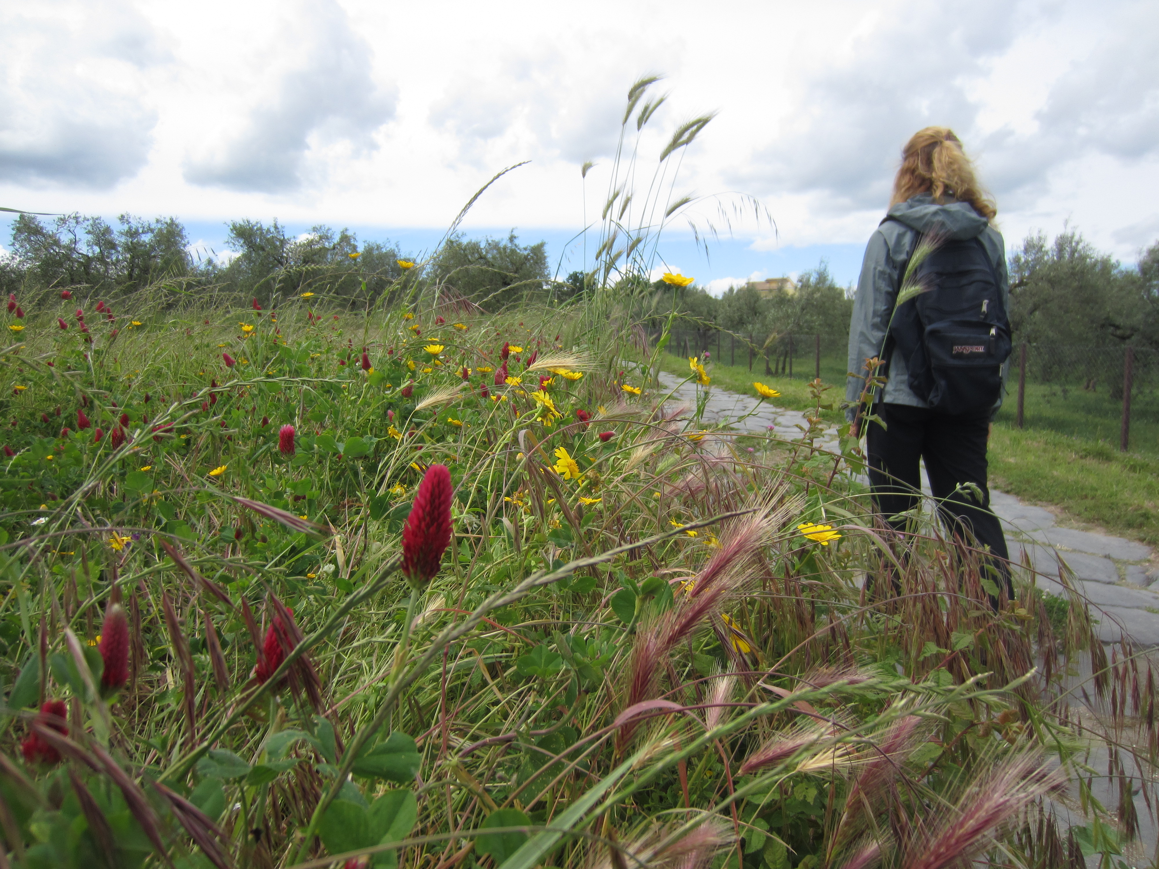
Longing for some exercise (other than walking the streets eating gelato and cheese), we hopped a train to the walled city of Viterbo and took a bus onward to the medieval hilltop town of Montefiascone for a day hike along the via Francigena.  This ancient pilgrimage route from France to Rome runs along the via Cassi established by one Cassius or another in the last centuries BC, and some sections of the Roman road are still intact.  The weather held and we wrapped our last full day in Italy with a late-night, local train ride back to Rome.

On the via Francigena to Viterbo, Italy
Pilgrimage among olives and flowers on 2000 year old road, between Montefiascone and Viterbo, Italy
Swinging above the Cattedrale di Santa Margherita, Montefiascone, Italy

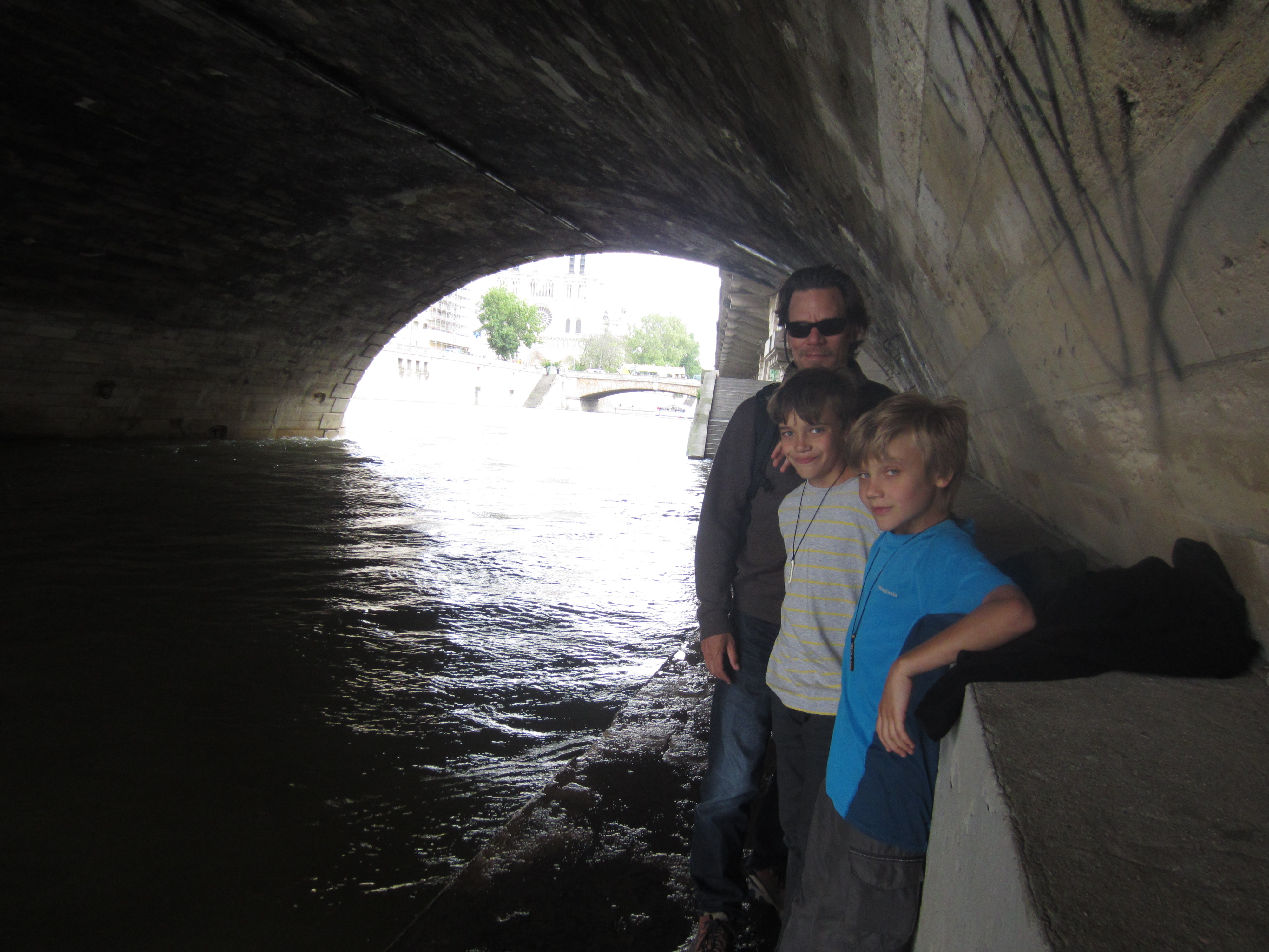
A quick two days in Paris was not enough to scratch the surface of the City of Lights, but we did manage a walk that took us to the Ile de la Cite, birthplace of Paris and home to the Notre-Dame Cathedral.  The boys, having had enough of European churches, took greater delight in a two-person, bouncy ride in the playground next to the cathedral than in the flying buttresses of the Gothic apse.  A stroll along the left bank of the Seine took us to the fabulous Musee d’Orsay housing a great collection of impressionist works, including many a Monet, Cezanne, Degas, Pissaro, Sisley and Renoir.  As always, the audio tour was worth the price, and we left knowing more about painting in 1870s France than we ever thought we’d care to know.  The Paris highlight was dinner in Versailles with the Froidvaux family.  Amy and her four siblings had hosted the four Froidvaux children (and vice versa) in the 1970s and 1980s.  This boisterous reunion was the first in nearly 30 years (made possible by Facebook).  As in Rome, the budget remained more or less intact thanks to the generosity of a friend.  (Thanks, Kate, for the great apartment!)

Rocking in the shadows of Notre-Dame Cathedral, Paris
High water on the Seine, Paris

An early morning cab ride to Charles de Gaulle and we were off on our final leg of the journey: to Iceland.  Why the not so obvious Iceland?  Simple.  Iceland Air had the cheapest fares from Europe to the US when we were looking for our return tickets and offered free layovers for up to seven days.  And what better place to put the final exclamation point on our world tour?  Iceland didn’t disappoint.

What to say about this strange place of only 320,000 hardy souls?  Hovering just south of the Arctic Circle, Iceland is very far north.  So, this time of year it is light out nearly 24 hours per day making it difficult to sleep even on the world’s most comfortable beds (which Iceland has).  Two-thirds of Icelanders live in the capital city of Reykjavik, so most of Iceland is rural with only sparse human habitation.  Trolls, which were commonplace at the time of European settlement in the 9th Century AD, are now endangered and possibly even extinct.

Rural Iceland from the road
On gravel ten minutes outside Reykjavik, Iceland

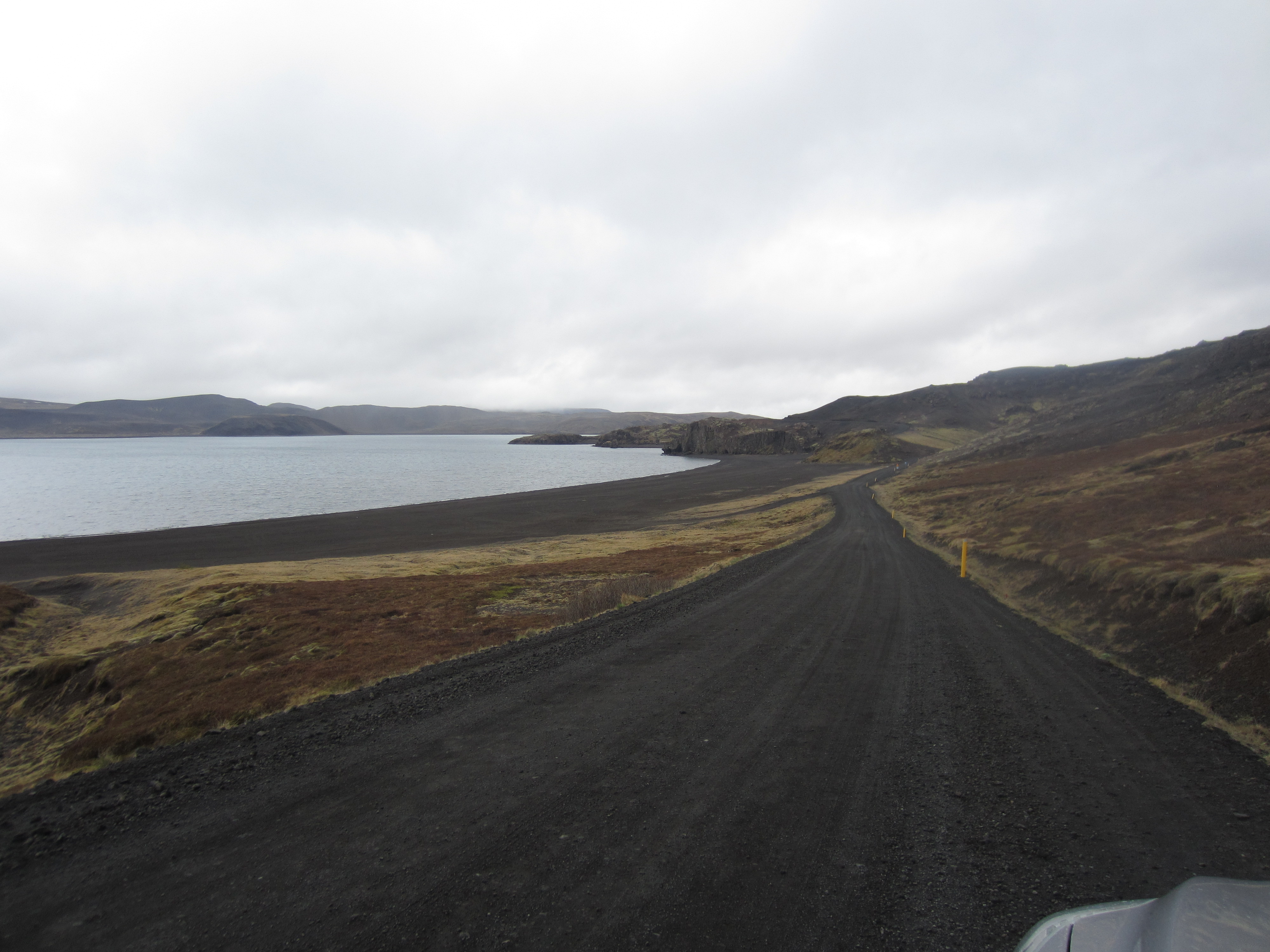
Iceland is essentially a volcano rising out of the North Atlantic, but it is a volcano covered with ice.  (Actually it is a lot of volcanoes covered with ice.  Each aircraft in the Iceland Air fleet is named after a different Icelandic volcano.)  This is a strange combination which leads to beautiful, stark scenery and serious natural disasters.  When a volcano erupts under a glacier, the ice melts.  The unstoppable torrents of water and ash, known as jokulhlaups, running off toward the sea are what cause most of the destruction in these events, wiping out bridges and roads and turning vast expanses of farmland into mud flats.

The muddy aftermath of a jokulhhaup, Skaftafell National Park
The muddy aftermath of a jokulhlaup, Skaftafell National Park

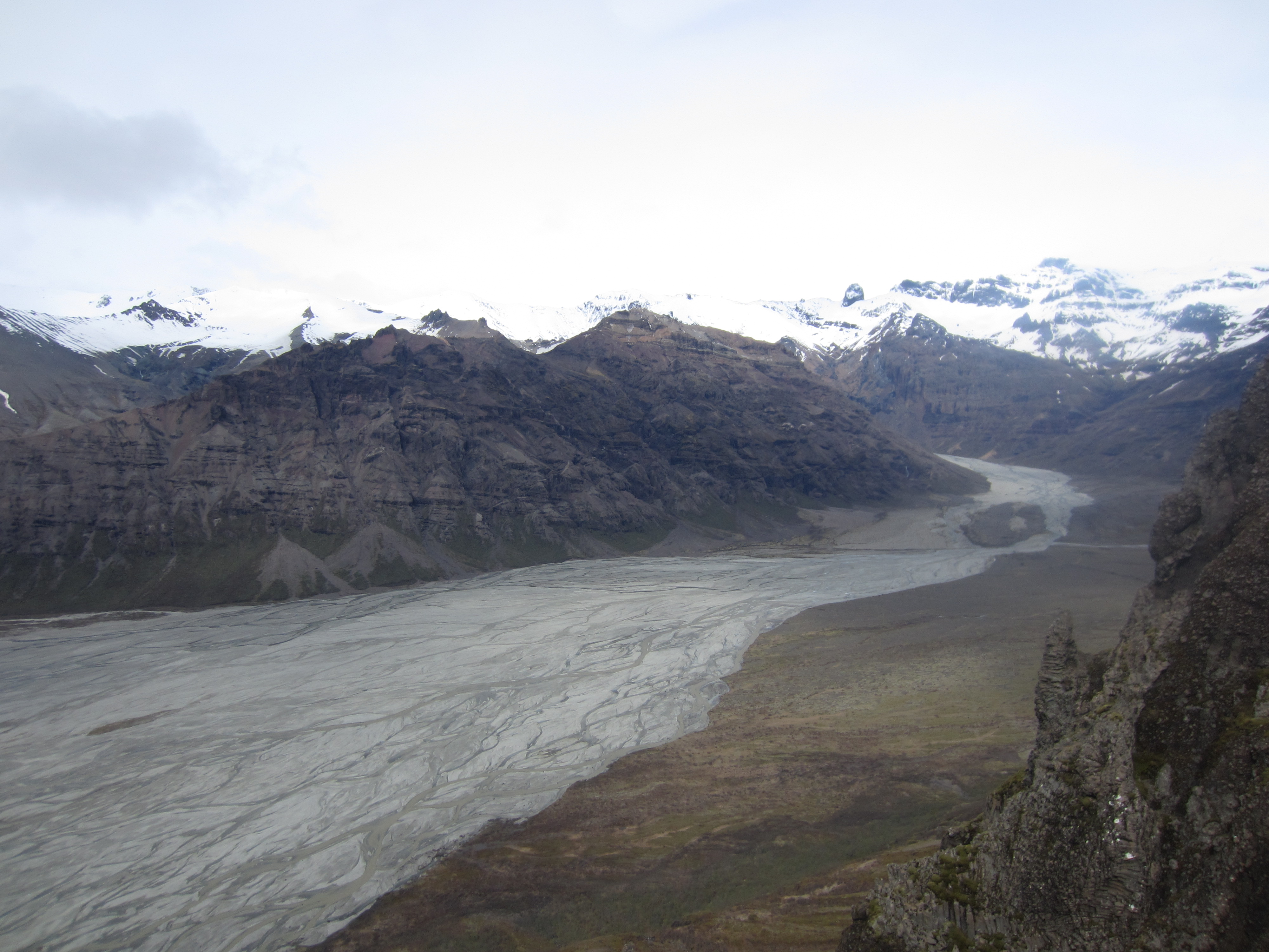
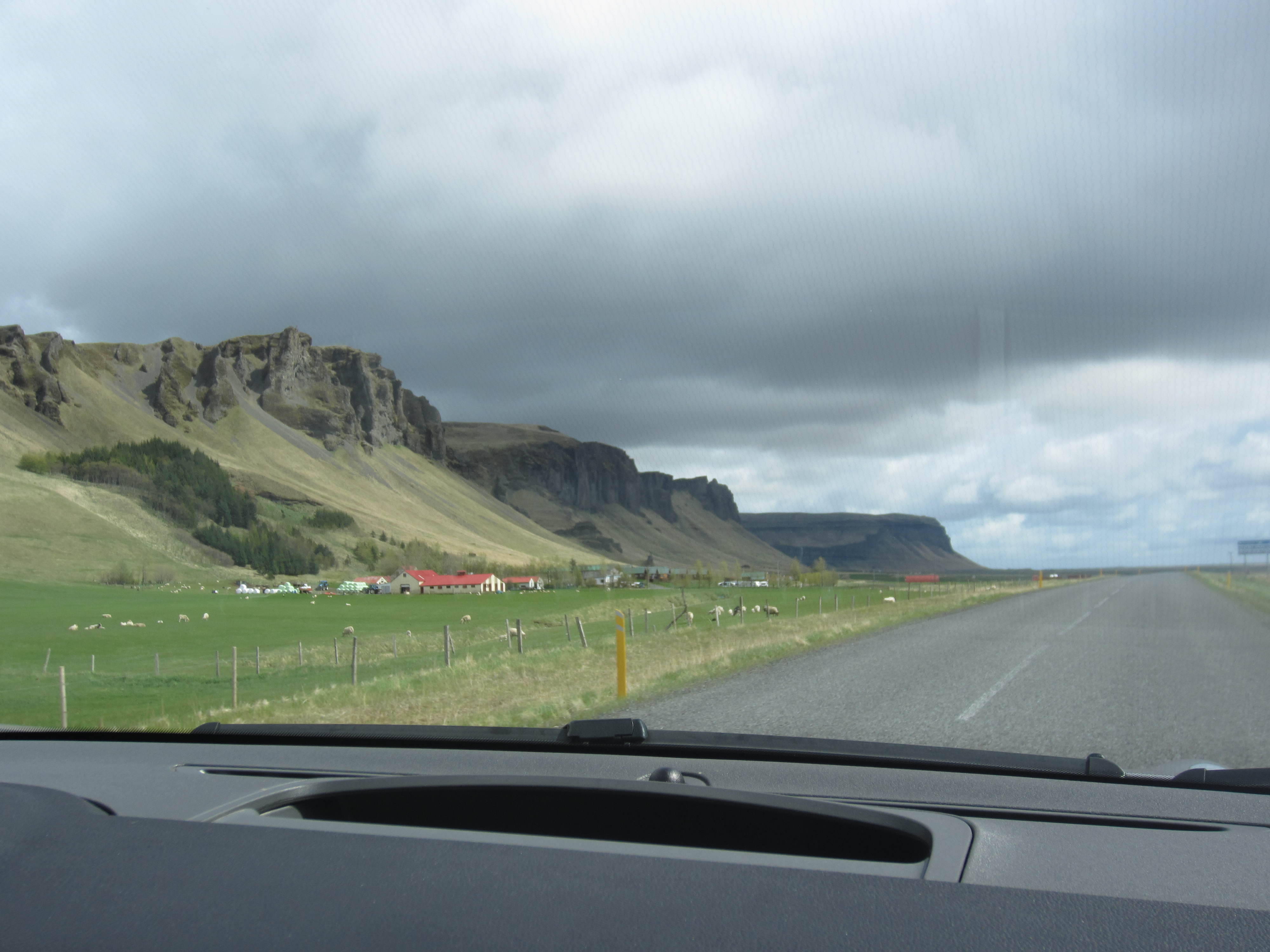
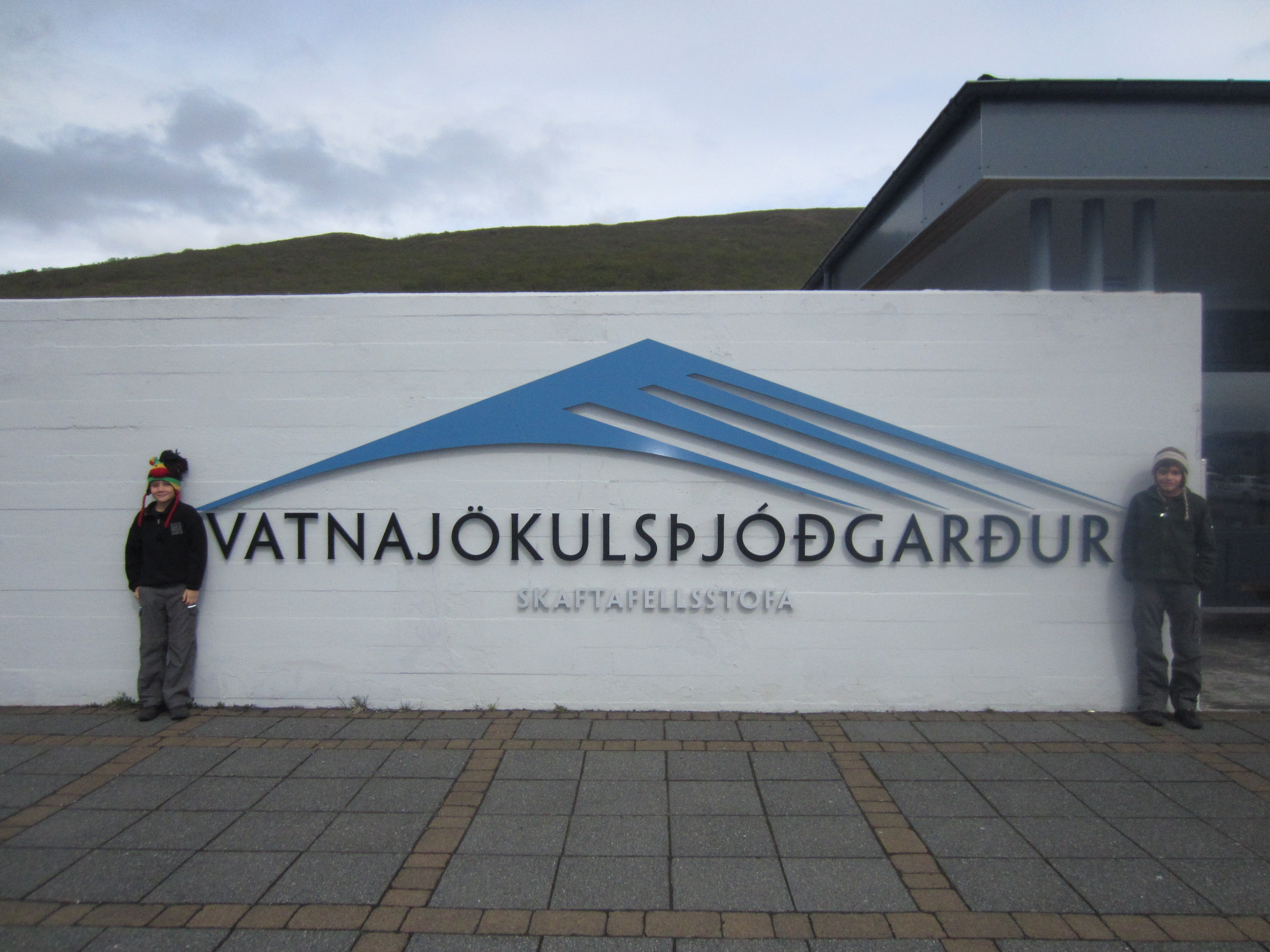
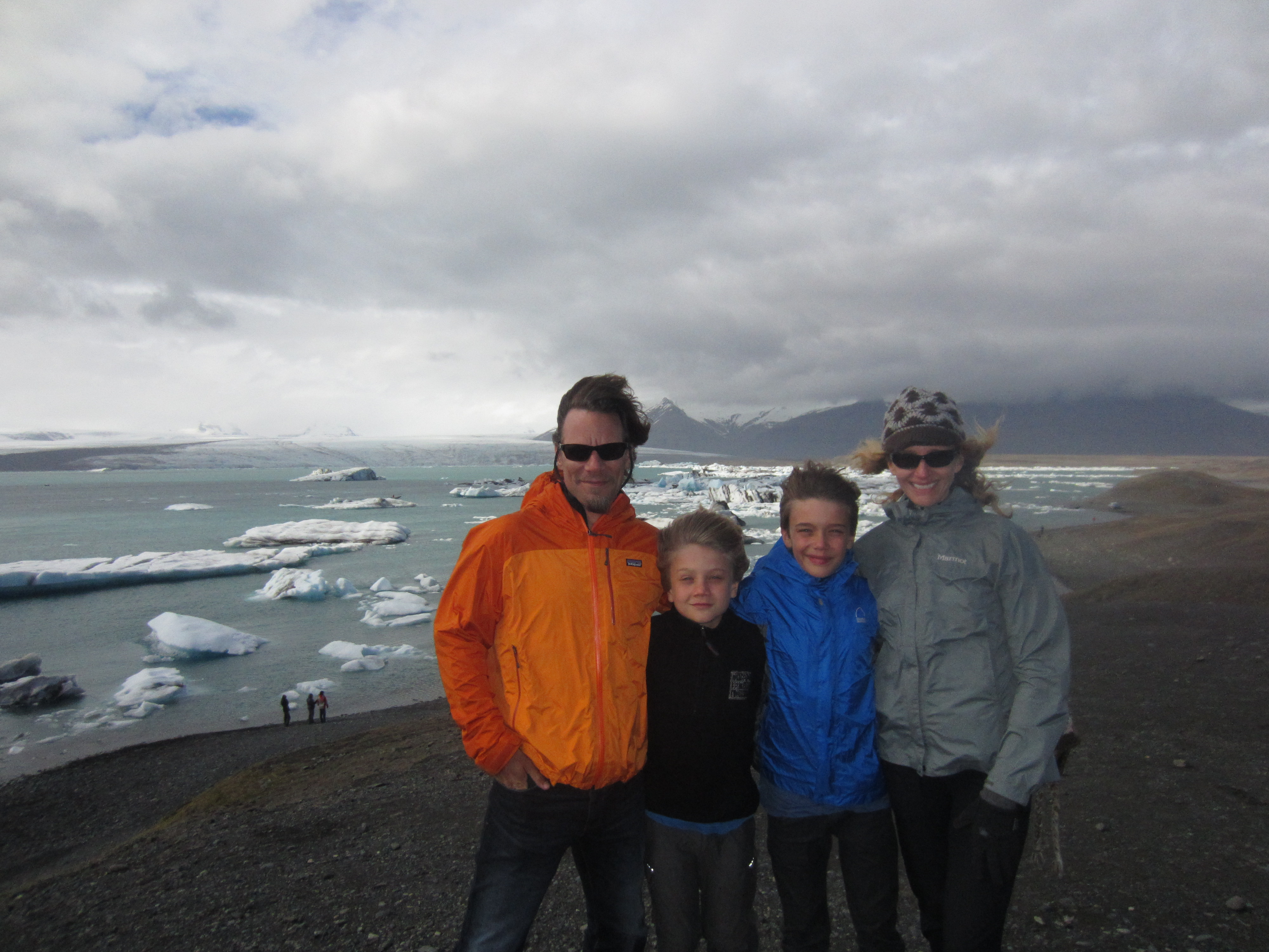
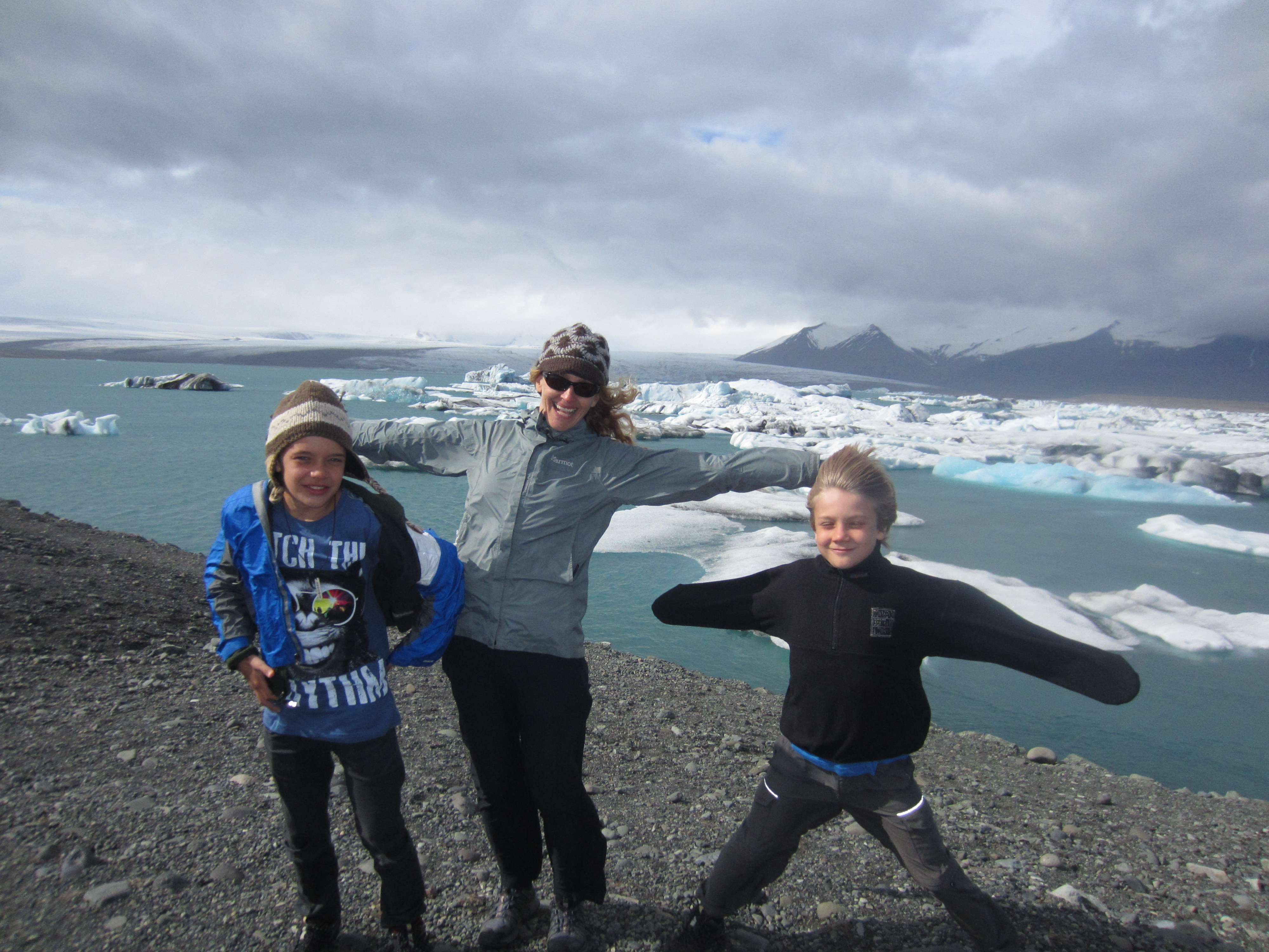
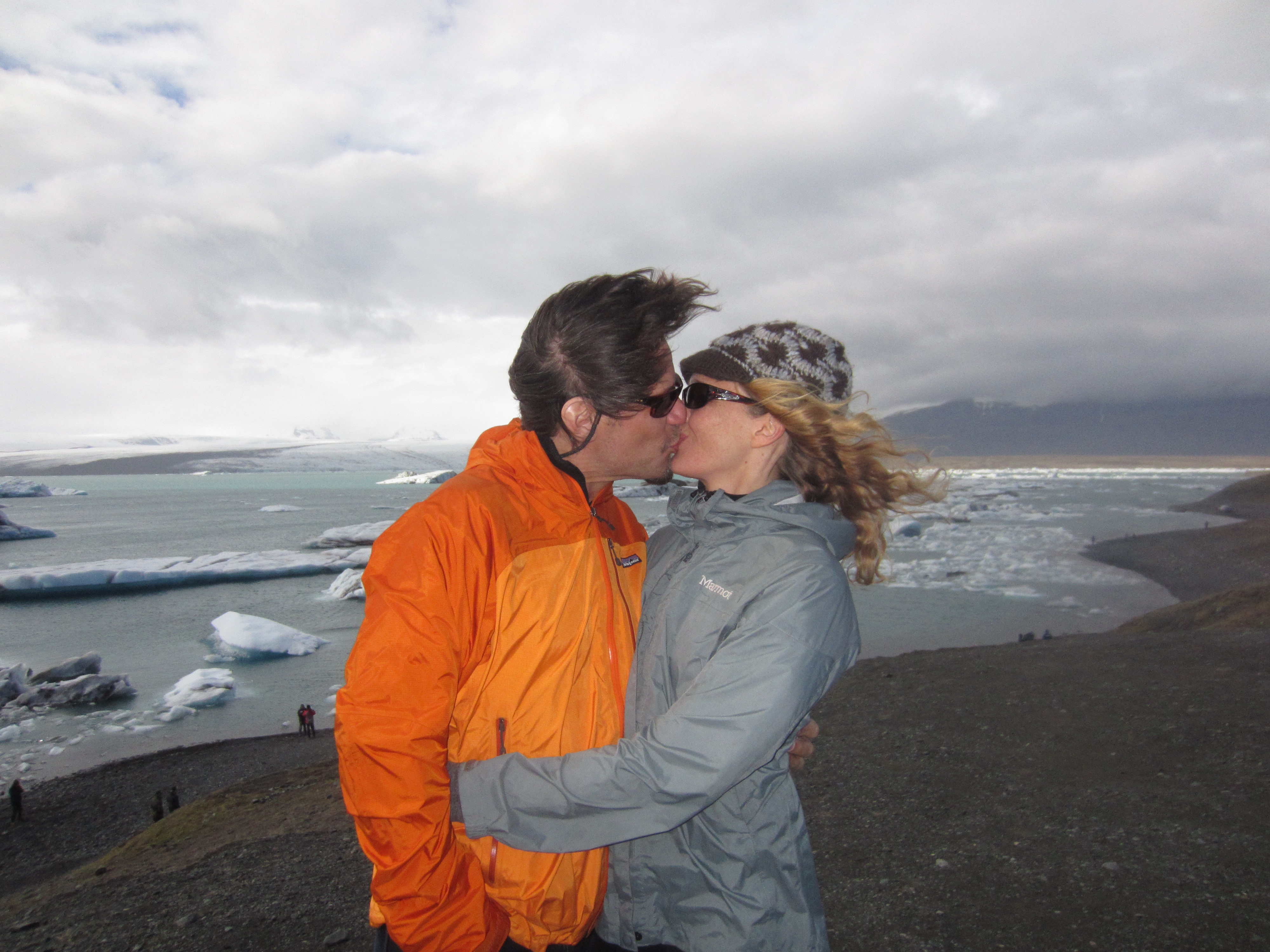
We managed to avoid the jokulhlaups and to enjoy the scenic beauty as we cruised the southern part of the island in our rented car.  Mostly overcast, we didn’t see the tops of many of the volcanoes, but were able to imagine them looming behind the clouds.  We also had to imagine the bulk of massive Vatnajokull, Europe’s largest glacier, and be satisfied with seeing just the fingers of this monster (each with its own unpronounceable Icelandic name) as they crept down from the mountain valleys to calve into melt water lagoons.  At the head of Breidamerkurjokull, the blue water of Jokulsarlon (Glacier Lagoon) — which has made cameo appearances in two James Bond films, Tomb Raider, and Batman Begins — clashed with the grey sea churning in through a tight channel at high tide.  Gazing down from a 1000 meter high promontory onto the scarred and pitted surface of another finger, Skaftafellsjokull, it was difficult to appreciate the scale of even this small portion of the ice sheet.  But the periodic booming crashes of ice falling off Morsarjokull as it reached its final precipice were a reminder of the size and power of these slowly diminishing natural phenomena.

Say what? Skaftafell National Park, Iceland
Overlooking Skaftafellsjokull, Iceland
Family shot at Glacier Lagoon, Iceland
Iceland is dangerous!
Iceland is windy!
Iceland is windy!
Iceland is snowy!
Iceland is snowy!
Iceland is for lovers!

Returning to civilization via the best bowl of lobster soup ever tasted by humankind, we rolled into Reykjavik for our final night of the trip.  With so much to choose from in Reykjavik and so little time, we opted to visit the Icelandic Phallological Museum.  (Yes, it is what it sounds like it is, and, yes, Amy decided to skip this one.)

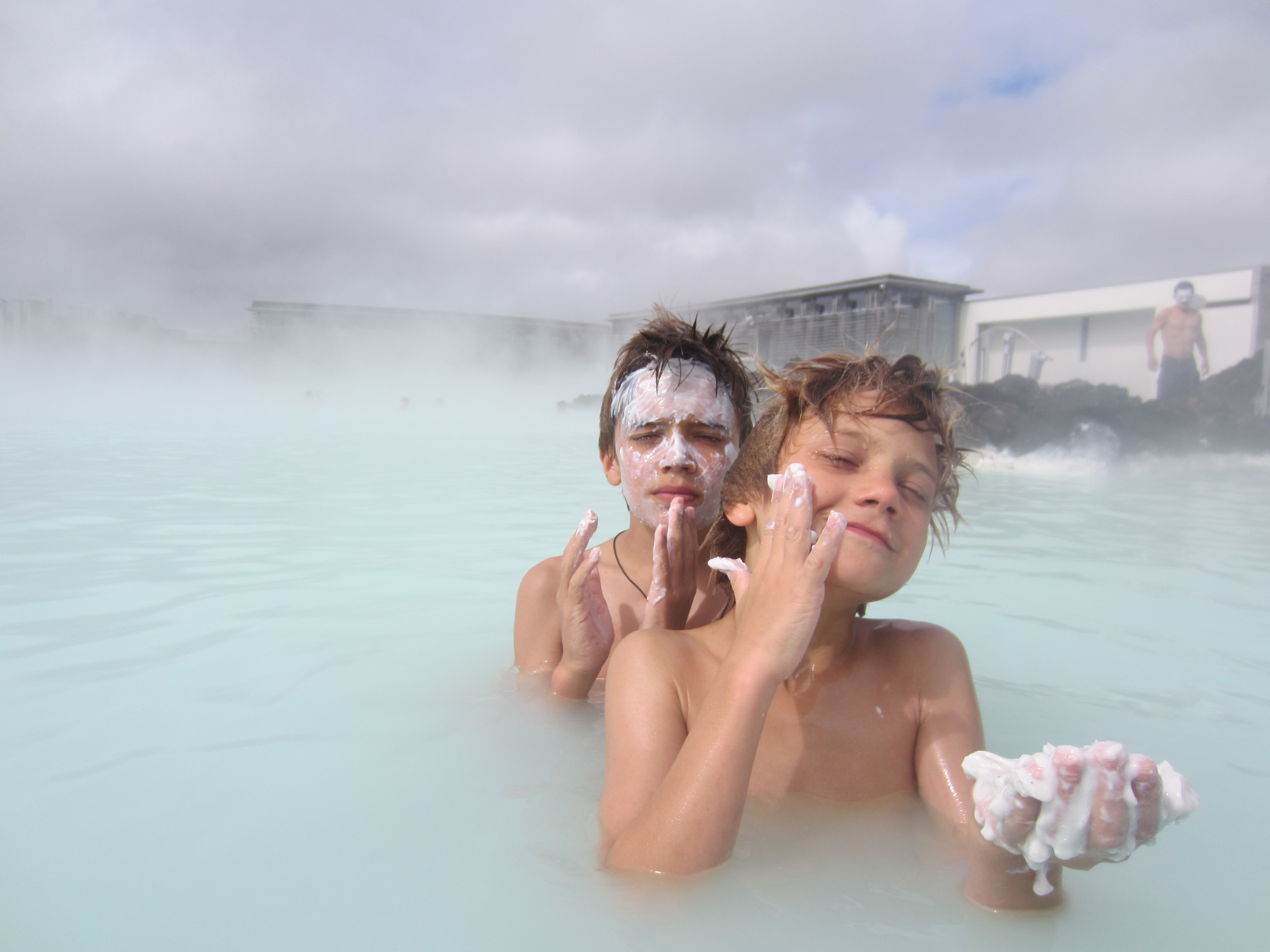
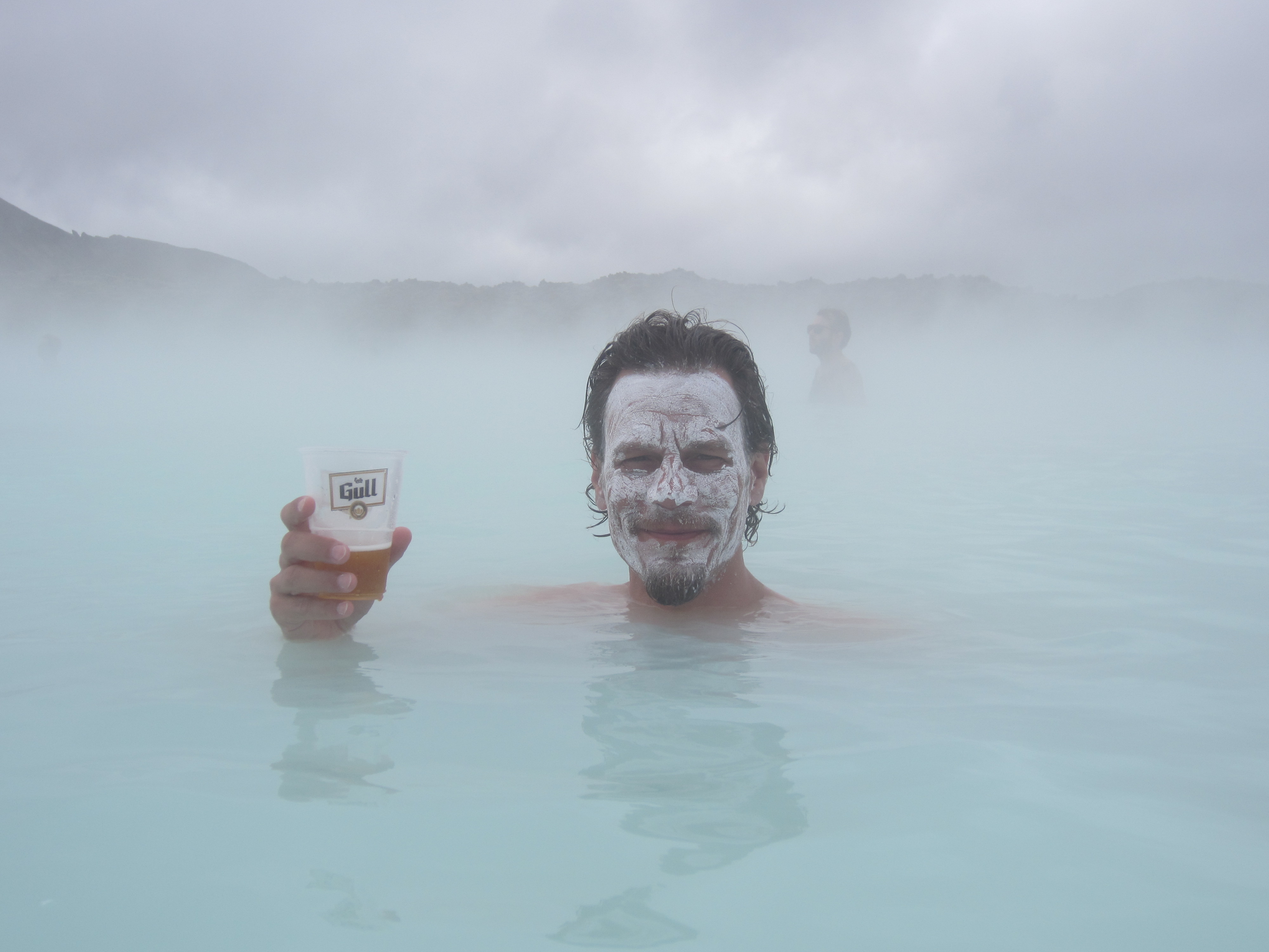
The next day, our last day in Europe, was spent soaking in the geothermal sulfur hot springs of the Blue Lagoon outside Grindavik.  Steam baths, saunas, silica mud facials, a huge steaming natural hot spring, and a cold beer (or blue “raspberry” slushy depending on age) were a great way to unwind before jumping our flight back into the eastern time zone of the United States.

Beauty treatment, Blue Lagoon, Iceland
Birthday boy: age-defying algae mask and cold beer, Blue Lagoon, Iceland

Trekking the Manaslu Circuit

The name of the game on the Manaslu Circuit is acclimatization: getting your flatlander body conditioned to survive in the low-oxygen environs at the top of 5160m Larke La pass.  Staying healthy, uninjured, warm and dry also count for a lot.  After leaving the Tsum Valley we started a six day climb along the Budhi Gandaki from 1800m to 4460m at Larke Phedi with the pass, and the dangers associated with it, always in mind.

Up we went, counter-clockwise around the Manaslu Himal with the towering centerpiece, Mt. Manaslu (at 8163m the 8th highest and 4th most deadly mountain in the world), and Manaslu North (7157m) often visible to our left and a variety of lesser peaks on all sides.  In order to start pushing our bodies’ limits and to avoid sleep-induced respiratory problems, we hiked high during the day and slept low at night.

Manaslu from Samagaon
Competing with donkey trains on narrow paths, Manaslu Circuit
Father and son carrying fodder for the livestock, Manaslu Circuit
Strange man with trekking poles and high-end rain gear, Manaslu Circuit
Up we go
Up we go
Following the Budhi Gandaki on ancient footpaths, Manaslu Circuit
Water-powered corn mill, below Bihi Phedi
Buddha images begin to appear on the mani walls, Manaslu Circuit
Braxton and the children of Lihi
Strolling through the village of Sho
Rolling into the village of Lho
Village gate, Shyala
Ceiling of village gate, Shyala
Digging potatoes out of their winter storage pit, Samagaon
Yak team plowing fields for the next potato crop, Samagaon
Braxton turning the dharma wheels, Samagaon

During a rest day in Samagaon (3520m) we hiked along the Manaslu Glacier to 4200m on the Manaslu basecamp trail.  As we rested at our high point we listened and watched as pieces of the glacier broke apart to plummet down toward the turquoise blue Birendra Tal below.  The sound of a groaning, cracking glacier as it warmed in the eastern morning sun was only surpassed by the booming crash of these periodic avalanches.

Overlooking Birendra Tal, Samagaon
Jaya (our guide) and the boys, Manaslu Glacier
Family shot, Manaslu Glacier

The next day, after reaching Samdo (3875m), we hiked straight up the nearby hill through low-lying, fragrant juniper to an altitude of 4500m.  As was the case on most days, clouds started to roll in and the wind picked up significantly by the early afternoon whipping the ubiquitous prayer flags into a frenzy.  Before climbing down we were able to get our first glimpse of the pass, a formidable jumble of loose rock and drifted snow in a landscape formed by glaciers long ago.

Team with the children of Samdo
Day hike turns windy, above Samdo
A first look at the pass, from above Samdo
Public fountain, Samdo

The last stop before the pass was the stone huts of Larke Phedi, an outpost with no other purpose than as a launch pad for crossing Larke La.  The afternoon in Larke Phedi was spent with another steep climb, this time to 4800m.  The views to the pass were partially obscured by cloud and mist adding to the ominous sense that we were heading into a place where mistakes could be quite costly.  That evening Braxton was stricken with a bout of food poisoning and the next day’s pass attempt looked uncertain.  Nonetheless, we set the alarms for 3:30am, and, Braxton having miraculously recovered, awoke from fitful sleeps to pack, sip some tea, gag down a chapati and boiled egg and head into the pre-dawn darkness on a slow but steady pace toward Larke La.

A beautiful morning hike to Larke Phedi
Old stones, on the way to Larke Phedi
More old stones as browns start to enter the slate color palette, on the way to Larke Phedi
Mother and sons with Manaslu North looming in background
Pulling in to Larke Phedi
Mountains come out of the sky above the roofs of Larke Phedi on a cold, cloudy afternoon

Within three hours we’d reached the pass and by 8:15am, having taken the requisite photos, we started a treacherous descent down the west side.  Ice-covered rocks, drifted snow, and loose gravel contributed to many a stumble mostly landing on our backsides and none of them serious.  We avoided turning ankles or breaking bones during the four hour downhill run and pulled into Bimthang (3590m) just after noon ready for a hot meal and our first hot shower in over a week.

4:00am breakfast on pass day, Larke Phedi
Approaching the pass, below Larke La
Getting closer, below Larke La
Not another family shot?!?! Yes, the obligatory group photo atop Larke La
Braxton with rasta monkey hat, Larke La
Henry triumphant, Larke La
Jaya and Tara, Larke La
Prayer flags and white mountains, Larke La

The final day of walking took us on a relatively gradual descent through stunning forest scenery to the trail head at Dharapani from which we made our way by road back to Kathmandu the next day.

Setting out from Bimthang on our last day of trekking
Rickety bridge over the Dood Khola (Milk River)
Eight shades of rhododendron
Some of the eight shades of rhododendron, below Bimthang

IMG_2458IMG_2459IMG_2465

Yellow flowers, below Bimthang

IMG_2462IMG_2457IMG_2297

Purple flowers, below Bimthang

IMG_2475

Strange flowers, below Bimthang
One mistake, game over.  Jeep road from Dharapani to Besisahar
“One mistake, game over” jeep road from Dharapani to Besi Sahar

Crossing Larke La — a literal high point in the trip — gave us a sense of accomplishment and satisfaction, but it was, at the same time, anti-climactic and felt like a milestone marking the final stages of the trip we’ve been on since mid-January.  Oddly, the ease with which we crossed the pass was almost disappointing: the much-feared disasters did not materialize and no stories of derring-do or perseverance in the face of tough odds emerged from the experience.  Yes, thankfully!  But the notion that the trip would be all downhill from here (back to the flush toilets and varied menu of Kathmandu, back to the wired world, back towards home via the clean, organized countries of Europe, back to our own beds, a car, a refrigerator) brought with it a feeling of loss; specifically, the loss of a sense of adventure that comes with entering the unknown.

Resigned to the fact that now we are heading toward the known, we are really looking forward to getting there!

Safe arrival in Besi Sahar

(We should add that a guide is required for the Manaslu Circuit, and we were accompanied by a great one, Jaya Bhandari, and a strong porter, Tara.  These guys were a tremendous help and the trip would not have been as successful or enjoyable without them.  They were both great with the boys.  Jaya is also a naturalist, birder, yoga instructor, and reiki healer, all of which came in handy throughout the trek.  If you are considering a trek in Nepal, get in touch with these guys through http://www.thirdpoletreks.com or directly with Jaya at bjayan24@hotmail.com)

Tsum Valley

We spent five days hiking into the remote Tsum Valley as part of our larger trek around the Manaslu Circuit.

The Tsum Valley runs through a protrusion of Nepalese territory surrounded by Tibet on three sides and nestled among peaks topping 7400m, including the massive Ganesh Himal to the south and east.  The Tibetan border is within 10km from all parts of the Tsum, but is only accessible via 5000m passes at the northeastern end of valley.  The southwestern entrance to the valley is through a narrow gorge at the confluence of the Budhi Gandaki and the Siyar Khola.  The misty weather on the day we entered, the moss draped trees, and the quiet walking path cushioned with pine needles all added to the sense that this was a secret place that time, so far, has forgotten.

Entering the Tsum Valley
Climbing into the Lower Tsum Valley on a rainy day with the Siyar Khola far below
A last steep climb into Chumling past a mani wall, Lower Tsum Valley

The Tsum Valley trek follows an out-and-back route that does not fit in to most trekkers’ schedules, and it has only been open to non-Nepalis for a few years.  As a result, the valley is relatively untouched by the trekking economy and culture; accommodation and food are very basic and the daily lives of the people in the valley revolve around the activities they’ve revolved around for hundreds of years.  This is in stark contrast to Langtang (reported on in an earlier post) or the Annapurna area (which Amy and I visited in the 1990s), both of which have been so overrun by trekkers that it is difficult to find any remnants of the pre-trekking cultures.  Perhaps the inconvenient remoteness (it takes a half day hair-raising bus ride, a half day bone-crunching jeep ride, and three days of walking to get to the entrance of the valley) and expense (permits and guides required) will help preserve the valley in its current state, but I wouldn’t bet on it.  Get there now.

In order to picture the Tsum Valley, imagine your most idyllic vision of Tibet: a high-altitude, wide valley of fields demarcated from by stone walls, a bright green, early wheat crop in the ground, dirt footpaths running through medieval villages, surrounded by soaring white peaks in all directions with a sometimes meandering, sometimes plunging river running through it.  Add all of the religious symbols of the Buddhist culture: the carved stones along the mani walls to remember those who’ve passed, the periodic stupa and chorten, and the ever present blue, white, red, green and yellow pray flags.  Add gaggles of children with cheeks so sun- and wind-burned that they bleed, their faces caked with dirt and snot but still full of energy and excitement as they march to school or chase livestock with a stick.  Remove the several decades of Chinese occupation and infrastructure development that have occurred just over the border and you will begin to envision this place.

Chorten up-valley from Burji, Upper Tsum Valley

IMG_2212IMG_2211IMG_2281

Water-powered prayer wheel unceasingly sending oms out to the universe, Lower Tsum Valley
Carved stone on mani wall, prayer flag, and trail far below, reentering the Lower Tsum Valley
A cluster of buildings in wheat fields, Lower Tsum Valley
Hiking in on an overcast day, between upper and lower valley
Hiking out in the sun
Small village with village gate in foreground, Upper Tsum Valley
Huge dharma wheel next to Milarepa's cave, Burji
Huge dharma wheel next to Milarepa’s cave, Burji
Milarepa, Tibet's famous yogi and poet turned green after eating nothing but nettles, Burji
Milarepa, Tibet’s famous yogi and poet turned green after eating nothing but nettles, Burji
A big yak, on the way to Mu Gompa
Children of Chumling, Lower Tsum Valley
On the way to school, Upper Tsum Valley
Big book bags, on the way to Mu Gompa
The guns have been silenced, but the sentiments of the civil war remain ("Long Live Himali Bhote Lama Liberation Front"), Chumling
The guns have been silenced, but the sentiments of the civil war remain (“Long Live Himali Bhote Lama Liberation Front”), Chumling

In order to imagine the basic level at which life is led in the Tsum, imagine a place where cow and yak dung are valuable commodities collected for fertilizer, but also for fuel.  Pack animals and people carry anything that enters or leaves the valley.  There are no motorized vehicles, no power tools, no cell phone signal, no stores (beyond the Chumling general store), no indoor plumbing.  We spent one long day hiking between meals in search of a pack of crackers or other snack to no avail.  There was no food for sale in this super rural and isolated place.  Electric power, if available, comes from small household photovoltaic panels (enough to power several compact florescent bulbs and to recharge batteries) or micro hydro generators.  The latter produce enough electricity to light a village or two, but only if they are functioning.  In Burji, for example, the electric wires were strung and connected, but there was no power.  Apparently the generator had failed, and, without a local technician to deal with the repair, they dismantled the unit and carried it back to Kathmandu for servicing.

Decorated donkey with full load, Tsum Valley
How plywood gets to the Tsum Valley
How huge steel cook pots get to the Tsum Valley
Braxton and a wall full of yak dung fuel, Burji

For three of our four nights in the Tsum we stayed in unconventional accommodation (ie, not a teahouse or lodge built to house trekkers).  In the small village of Chumling we found shelter in tiny rooms above the Chumling general store.  Happy to be out of the rain that had plagued us in the early days of the trek, we ate what was served while squeezed in front of the store counter looking at the wide variety of goods for sale.  Alcohol and cigarettes dominated the selection, but shoes, biscuits, bulk salt and sugar, soap, a few cell phones (to be used we don’t know where), and other strange items like vacuum packed ‘Instant Spicy Fish’ were also on offer.  Many of these goods had come down the trail from nearby Tibet.  Pirated timber moves in the opposite direction from the lower valley up across the border.

Chumling general store, Lower Tsum Valley
Breakfast remains with store owner's daughter guarding the goods, Chumling, Lower Tsum Valley
Breakfast remains with store owner’s daughter guarding the goods, Chumling, Lower Tsum Valley
Watch your head, typical bedroom door, Chumling
Typical Tsum Valley kitchen, Chumling
An afternoon read with milk tea, Chumling

Our second night, in the Upper Tsum Valley village of Chekompa, was spent in a Tibetan family’s homestay.  We slept above the stable under a loosely slated roof and draped plastic tarps that did not prove to be 100% waterproof when tested by a midnight shower.  We’d spent most of that day hiking steeply uphill from the lower to the upper section of the valley and slept pretty well despite the drips.

Our hostess in Chekompa
Leaving Chekompa
Leaving Chekompa

IMG_2179

Our third night, in the even smaller village of Burji, we stayed in a newly-opened lodge with a legitimate roof and a sign advertising 24 hour hot showers.  The leak-proof roof provided a comfortable night’s sleep.  The hot showers proved to be aspirational, perhaps to be realized at some future date when the proprietor invests in solar panels or a gas canister hook up.

We spent the fourth day hiking from Burji up to Mu Gompa, a monastery perched on a wind swept promontory at 3700m.  This barren place houses a group of young monks who cooked up bowls of instant noodles and cups of steaming butter tea, the only food within miles.  Several kilometers distant and over 1500m higher one could access the passes into Tibet.  We met a group of young men who were hiking into this high area to spend several months gathering plants used in Tibetan medicine.  They anticipated that Chinese merchants would come across the border to buy their harvest before the end of the season.

Boys on the way to Mu Gompa
An uphill kicker at the end of a long hike, Mu Gompa
A monk and his cooking stove, Mu Gompa
Braxton in the kitchen door, Mu Gompa
Posing for the group photo, Mu Gompa
Posing for one of many group photos, Mu Gompa
The view down valley from Mu Gompa

Our fourth and final night in the valley was spent in the Rachen Gompa nunnery where the nuns had indeed managed not one but two solar hot water systems, one for the nuns and one for the faculty.  The trickle of hot water on a cold evening at over 3200m felt like heaven.  Even closer to heaven (or at least more closely related to the topic) was our observation of an early morning puja in the central monastery.  Rising at 5:30am we followed our ears to the daily breakfast-n-prayer ceremony where 50+ crimson-robed, shaved-headed nuns ranging in age from teenaged girls to wizened elders sat cross legged in rows chanting, drumming, blowing horns and conch shells in an orchestrated cacophony, intermittently sipping salty butter tea and eating from bowls of dry tsampa porridge.  We sat, watched and listened, sipping our own butter tea.  With our eyes closed we could begin to hear the patterns emerging from the chanting, which started to feel less confused and more powerful as we leaned against the brightly painted plaster walls in the centuries old temple in the middle of nowhere.

Henry in the yard of Rachen Gompa, Upper Tsum Valley

We felt a deep sense of awe, but also of sadness, hiking out of the Upper Tsum Valley on our fifth day.  Down we went on this sunny but chilly morning passing through all of the villages and fields we’d passed during our ascent.  Down narrow, steep stairs cut into the sides of cliffs with precipitous drops and certain death by falling on one side and the threat of crushing rocks falling from above on the other.  Past the mani walls, across the suspension bridges, along the dirt paths between mud plastered stone houses, walls piled high with firewood gathered over the year and pasted with hand-patted dung patties drying in the sun, to emerge from the valley by the end of a long day and reenter the flow of human and animal traffic climbing through the Nubri Valley of the Manaslu Circuit.

Leaving Rachen Gompa
A river runs through it, upper reaches of the Siyar Khola

IMG_2282

Boys hiking out on a sunny day, entering Lower Tsum Valley

WWBD?

This is, more or less, how the story goes.  Maya Devi, a pregnant queen living in what is now the Terai region of Nepal, was strolling along one day some 2700 years ago when she went into labor.  Soon after, she gave birth to a son as she stood with her arms around the branch of a bodhi tree.  It turns out that this child, named Siddhartha, would emerge some 30 years later from his protected and privileged existence behind his father’s palace walls to seek the meaning of life.  He succeeded in his quest and is now known as the Buddha.  Several centuries after his birth, King Ashoka identified the Buddha’s bodhi birth tree in the area of Lumbini Village.  He placed a stone to mark the exact location of the birth, and knocked the tax burden of the Lumbini villagers down to one-eighth of its previous levels.  Not a bad windfall for living near a tree.  I should mention that Siddhartha is thought to have emerged from his mother’s armpit, which might explain her death seven days later.

We had the opportunity to visit the birthplace of the Buddha, and to observe that the armpit theme is alive and well in both the village of Lumbini and in the sprawling Lumbini Development Zone that surrounds the spot demarcated by King Ashoka many centuries ago.

The village consists of a mosquito infested, one block dirt road lined with dark, flea bag hostels and a few trinket shops.  During our stay a “dharma story” consisting of spoken word, ‘singing’ and musical accompaniment (that reminded me of my children’s pre-school winter concerts) was blasting through a village-wide PA system of speakers starting at dawn and continuing into the night.  Static, distortion and an overly long and wandering storyline seemed to be the main thrusts, but, not being able to speak Nepali, this was difficult to confirm.  We spent two sleepless nights swatting at buzzing, pesky, blood sucking bastards, and we have resumed our anti-malarial intake.

The Lumbini Development Zone is a walled compound of several hundred acres that encompasses the “birthplace” (now covered by a dark building meant to preserve the exact spot); a long, narrow reflecting pool (in which two speedboats sat ready to buzz passengers up and down its length); which divides the western monastic zone (in which massive monasteries have been built by countries practicing the crimson-robed, Mahayana branch of Buddhism (eg, China and Korea)) from the eastern monastic zone (in which only slightly less massive monasteries have been built by the saffron-robed Theravada countries (eg, Thailand and Sri Lanka)); and, amidst a maze of road and path construction, appropriately placed in the center of this armpit, sits a bizarre statue meant to depict the Buddha and the pose he struck immediately upon being born (see photo below).

One cannot help but wonder what our friend might do, or say, if he returned to this spot today.  WWBD?  Probably, say WTF?!?!

WWBD? Especially if he saw this statute of him, Lumbini
WWBD? Especially if he saw this statute of himself, Lumbini
Under a bodhi tree (not THE bodhi tree), Lumbini, Nepal
Under a bodhi tree (but not THE bodhi tree), Lumbini, Nepal
Monks under a bodhi tree, Lumbini, Nepal
Buddhist monks under a bodhi tree, Lumbini, Nepal
Hindu devotees under a bodhi tree, Lumbini
Monks with microphones under prayer flags strung between bodhi trees, Lumbini
Bicycles for Buddha, on the path to Nirvana, Lumbini

Village life

We had the opportunity to observe Nepalese village life close up during our time in Betahani just outside the Bardia park boundary.  Our other observations of village life have been in the high altitude areas of Langtang and from the windows of various vehicles as we whiz by on the roads.  From what we can see, village life in Nepal revolves around food production and preparation.

Late afternoon stroll, Betahani
Wheat ready to harvest, Betahani Village
Wheat ready to harvest, Betahani
Betahani
Betahani
House of elephant grass woven into bamboo structure and coated with layers of mud, Betahani

In the Terai, the lentil and wheat harvests are in full swing.  In other regions, the wet rice crop is in the ground in anticipation of the coming monsoon rains required to irrigate this water-intensive crop.  All of these staples require drying and hulling to remove husks and make the grains ready for consumption.

We’ve observed three methods of hulling.  Mechanized hulling is rare, but it is available for those farmers who can afford to pay the itinerant hulling machine operator who hauls his rig from village to village this time of year.  (Other forms of mechanized farming, such as the use of tractors or rototillers to prepare the soil, are equally rare in Nepal and every other country we’ve visited with the exception of Thailand.)  It is less expensive to have a pair of oxen stomp over your rice, wheat or lentils for hours until the grains have been broken loose from their hulls.  We observed this method in several villages.  Dried lentil stalks are piled on the hard-packed earth while the beasts tread a slow, tight, repetitive circle.  When that stage is finished, the husk-less grains must be gathered up by hand and separated from various non-grain items and debris.  The resulting small basket of lentils looks paltry against the effort required, and makes one thankful for the rice and beans aisles in our grocery stores.  The final hulling method is the “road hull” in which sheaves of wheat are placed on the road in anticipation of large trucks and buses passing by to do the work.  The heavy vehicles provide a free hulling service, but it is a dangerous technique (especially for the woman [yes, this is women’s work here] tasked with gathering up the grains at the end of the day), and it makes you wonder about the “natural” ingredients you might find in your bread.

Having seen the ox and truck methods in action I will no longer wonder “how did this rock get in my rice?”, and I will take more seriously the suggested first step in most lentil recipes: rinse lentils.

The truck hulling technique on the road to Pokhara, Nepal

(As a side note, one hazard of growing crops next to a huge protected area full of elephants, like Bardia National Park, is that elephants love to eat those crops.  Twice during our time in Betahani we heard large crowds yelling and screaming in the middle of the night.  The entire village had come out to scare off a rogue elephant who’d found his way into the wheat fields.  The next day we noticed a list of warnings posted in our room, all of which addressed the dangers of wandering outside at night to see what the commotion was about.)

Food preparation, which often requires a heat source, is another oft-observed activity.  Not just the cooking, but the acquisition of fuel.  Coming across a shambling pile of sticks and branches is a regular occurrence on the roads and trails of Nepal.  These turn out to be either very young or very old people hauling bundles of firewood back to the cook stoves.  Firewood is scarce in most parts of the country, so alternative fuel sources have been developed.  On the Terai we saw what looked like long mud bricks in regular stacks drying along the side of the road.  These turned out to be the Nepalese version of Duraflame firelogs consisting of animal dung and the chaff extracted from the hulling processes described earlier.  In other places, straight dung (yak chips) augments firewood as fuel for heating and cooking.  But our favorite fuel source is the up and coming use of biogas.  Animal and human waste are stirred up and placed in a digester under an airtight dome (usually buried underground).  As these wastes decompose, gases are released and captured in the dome.  Enough pressure is created by the gravitational push of additional dung coming down the shoot to push the gas out a valve at the top of the dome and to an efficient, single burner cook stove.  These systems are being installed at the household level throughout the country.  Of course the use of poop to create gas to cook food is intriguing, especially for a 9 and 12 year old boy, and the talk of developing other ways to generate and capture biogas has been seemingly endless.

A final note on the importance of food in village life has to do with livestock.  Animals are everywhere in Nepal: in the countryside and in the cities.  Water buffalo are used for traction (hauling carts and tilling fields), donkeys and horses as pack animals (especially in the roadless mountain areas), cows and cow/yak hybrids are sources of milk, goats are also sources of milk and of meat, pigs are here (although they are less common in Nepal than in Southeast Asia), and chickens run wild (in fact the domesticated chicken has its origins in the wild chicken of northern India and the Terai) as do dogs (which don’t appear to be a food source here, unlike other countries we’ve visited on this trip).  Tending these creatures is a focal point in the life of many villagers.

Below a few pictures of these beasties.

Water buffalo, ox cart and heavy load, village of Betahani
Holi chickens, Betahani
Andy Warhol's widespread, inter-species influence on display, Betahani
Andy Warhol’s widespread, inter-species influence on display, Betahani

Temples of Kathmandu Valley

Temples, other sacred structures and religious iconography are everywhere in Nepal.  It would take months of determined sightseeing just to visit all of the temples in the Kathmandu Valley and many years of study to understand them fully.  It would be easy to overdose on religious studies and temple touring, so we’ve engaged in both on only a limited basis.  But religion plays such a central role in this society that, not only is it an unavoidable part of any trip to Nepal, one cannot understand Nepal without first trying to understand the two main religions here: Hinduism and Buddhism.  This entry tries to give an account of some of what we’ve seen of these religions in the architecture and statuary in the Kathmandu Valley.

We started our time in Kathmandu Valley in the Tibetan Buddhist neighborhood of Boudha within sight of the huge Bodhnath Stupa.  This stupa has attracted Tibetan refugees and travelers over many centuries and is a centerpiece of the exiled Tibetan Buddhist community in this country.  For us it was a first introduction to the religious foundations of Nepal.

Late afternoon at the Bodhnath Stupa, Boudha

Two things became immediately apparent as we walked around this stupa in the late afternoon of our first day (always clockwise with the stupa on our right!).  The stupa (originally constructed around AD 600) is still a focal point of current religious practice.  Unlike many of our European churches which have been abandoned by the faithful even while swarmed by tourists, this stupa, and all of the other temples we visited, are in daily use by their respective adherents.  The other thing that struck us was the incorporation of icons that we did not understand as being “purely” Buddhist.  The Buddha eyes on the tower below the spire and the five-colored prayer flags blowing in the breeze are both identifiable to even the minimally initiated as Buddhist icons or objects.  But there at the base of the stupa, in fact incorporated into the structure of the stupa, was a temple dedicated to Hariti.  Who is this Hariti? we wondered.  The goddess of smallpox, we were told.  When we ran into Hariti several weeks later at the Swayambhunath Stupa we were told she is the goddess of fertility and a protector of children.  Upon further investigation, it turns out that the story of Hariti (aka Ajimadya or Sitalamaju) is a long one starting in what is now Iran, and her relationship with Buddhism is complex.  (We’ve come to find that long, complex stories are the norm here!)

The next question that came to mind was whose goddess of smallpox and fertility?  Hariti, it turns out, was a non-Buddhist who was instructed by Buddha about the value of compassion.  As a result, she changed her evil ways (killing children) and became a guardian of the Buddha’s doctrine.  And yet there at the base of one of the largest and most important Buddhist structures in Asia, Hindus, among others, were praying to Hariti.  This same scene repeated itself several weeks later when we visited the Swayambhunath temple complex, a chaotic jumble of Hindu and Buddhist structures and iconography (centered on the Buddhist Swayambhunath Stupa but also including a prominent Hariti Temple) at the top of a high hill west of central Kathmandu.

Reaching the top of the eastern staircase with gilded Swayambhunath stupa spire and brass-plated dorje (thunderbolt) symbol (foreground), Swayambhunath
Reaching the top of the eastern staircase with gilded Swayambhunath Stupa spire and brass-plated dorje (thunderbolt) symbol (foreground), Swayambhunath
Preparing the butter lamps around the Nagpura (water symbol), Swayambhunath
Buddha icons atop Hindu yoni, Swayambhunath

In this last photo, one might expect a Shiva lingam (a Hindu symbol) atop the yoni, but there sits Buddha.

These two initial impressions — religious structures in regular daily use and a complex intermixing of Buddhist and Hindu iconography and architecture — became enduring themes as we visited or came across the artifacts of religion throughout our first month in Nepal.

The Bodhnath Stupa was just the beginning.  The next day we visited the Pashupatinath temple complex as the Hindu faithful prepared for the Maha Shivaratri festival (about which we reported briefly in an earlier post), and here too the intermixing of the two religions was apparent with Buddhist icons appearing here and there and a few of the hermit meditation caves set aside for Buddhist devotees.

The notion of daily use, the deep incorporation of religion into the regular routine of the Nepalese and the mixing of Hinduism and Buddhism were on display during a stroll through a residential/commercial district of old Kathmandu during which we encountered a 15th Century Buddhist stupa across from a temple dedicated to Shiva.  One block on we hit another stupa before passing an altar to Ganesh and then a 9th Century stone relief of Shiva and Parvati, then another Hindu temple with a carved Garuda, and, turning the corner, a short, unremarkable 5th Century standing Buddha statue tucked inconspicuously between a hardware store and the neighboring business.  All this in the first five minutes of a casual stroll through busy, narrow streets with secular life churning around the ancient and the sacred.  We walked on for another 30 minutes through a similar landscape before being driven inside by an unusual cloudburst for a cup of milk tea.

The constant presence of religious objects repeats itself throughout the Kathmandu Valley, an area stretching approximately 15 km north to south and 30 km east to west and consisting of many smaller towns and neighborhoods.  Boudha and Dhulikhel are two  we’ve written about.  We also visited Panauti at the confluence of the sacred Roshi and Pungamati Rivers (yes, more sacred rivers) and Swayambhunath, the “Monkey Temple”, mentioned above.  Finally, we spent one night in the former city state kingdom of Bhaktapur with its famous Durbar (or Palace) Square and its many other plazas surrounded by temples to the various gods.  Our travels within the Kathmandu Valley only scratched the surface in this densely populated and historically rich part of Nepal.  In all of these places it is difficult to walk ten feet without passing a Ganesh figure smeared with red paste, or a Buddhist stupa surrounded by prayer flags.  And with the panoply of gods and other characters (demons, various incarnations of each god, their children and consorts, and their animal companions or vehicles [vahana]), it is often difficult to understand who is being worshiped and for what purpose.  Some gods are well-known and the obvious object of worship if you know what to look for (a trident is Shiva’s weapon of choice, a Garuda is Vishnu’s vahana), but others are a bit more obscure.  For example, the toothache god hiding in an old snag of wood covered with coins that had been nailed to the misshapen tree trunk.  The fact that his little shrine was located in a district with lots of dentist offices didn’t make his purpose that much more obvious to the uninitiated.  For what is, in some sense, a one-man show, the Buddhist system also includes a surprisingly large number of characters, many of them borrowed from the older Hindu system.  (This intermingling includes the belief among some Hindus that Buddha is the ninth incarnation or avatar of Vishnu.)

Below are a few more photos of religious buildings and objects.

Fortune telling (bottom left) in Hindu temple, Panauti
Unamanta Bhairab Temple, Panauti
Temple of the dog (Shvan), Bhairab's vehicle or vahana, Bhaktapur
Temple of the dog (Shvan), Bhairab’s vehicle or vahana, Bhaktapur
Royal Palace, monuments and temples of Durbar Square, Bhaktapur
Five-storied Nyatapola Temple, Taumadhi Tole, Bhaktapur
Raising the roof on Bhairab's chariot, Bhaktapur
Raising the roof on Bhairab’s chariot in preparation for the Bisket Jatra festival, Bhaktapur
Durga, a fearsome manifestation of Shiva's consort Parvati, Golden Gate of the Royal Palace, Bhaktapur
Durga, a fearsome manifestation of Shiva’s consort Parvati, Golden Gate of the Royal Palace, Bhaktapur

And here are a couple that capture secular life in the Kathmandu Valley.

Typical street scene, Bhaktapur
Bath time with plastic, metal and clay vessels, Bhaktapur

But notice the white stupa structure on the left side of the last photo under which this youngster is bathing.

B.P. Shresta: Getting it done in Dhulikhel

This is an entry about a man who has made a real difference in his community over the course of his lifetime, and who attributes his successes to a year spent in the United States.

We had the pleasure of meeting Mr. B.P. Shresta of Dhulikhel, Nepal during a two-day visit to his hometown set on the eastern rim of the Kathmandu Valley.  We were introduced to B.P. by our family member, Dr. Jerry Bunker, who spent some time in Dhulikhel practicing medicine.  “Bunker” (as B.P. fondly calls Jerry) and B.P. became friends and have maintained that friendship over the years and distances.  We benefited greatly from the Bunker-B.P. connection when we contacted B.P. and were invited to spend time with him and his family at their hotel, the Himalayan Horizon, named for the magnificent mountain views from the rim of the valley.  Clouds obscured the views most of the time we were in Dhulikhel, but meeting B.P. and hearing his story more than made up for the mountain-less scenery.

B.P., never before having left Nepal, traveled to Davis, California in the late 1960s for one year to teach the Nepali language to outbound Peace Corps volunteers.  B.P. claims that while in the United States he observed a mentality, an approach to problem solving, and a “can do” attitude that contrasted sharply with what he grew up with in Nepal: an attitude of fatalism (his word).  B.P. marveled at the freedom and defiance of the hippy culture and at other new ideas that were in the air including individualism, entrepreneurialism, and civic engagement.  He also absorbed these ideas and transported them back to Dhulikhel where he returned after his year abroad.  In the subsequent 45 years Dhulikhel has been the beneficiary of B.P. and his American experience.  (B.P. claims it was his visit to the United States that set his wheels in motion.)

Upon his return, B.P., seeing that those same hippies were starting to visit Nepal and needed lodging, started a four-room guesthouse with no indoor plumbing.  By the time we visited Dhulikhel, he’d built the Himalayan Horizon, a four-building compound with a conference center and 60 high quality guestrooms (the nicest we’ve stayed in on this trip).  But B.P.’s commercial activities were only the beginning of his contribution to Dhulikhel.

A true visionary, B.P. has been able to see things both as they are and as they could be.

He started with a municipal water system.  In the country with the second largest reserve of freshwater in the world, Nepal’s water distribution system is abominable.  In the pre-B.P. Dhulikhel water was hauled in buckets up from the valley.  In post-B.P. Dhulikhel a German-engineered water system brings water from a spring 14 kilometers to the south supplying the townspeople with water at the twist of a tap.  Around this same time, B.P. began to engage in politics, serving as the mayor of Dhulikhel for 14 years.

During Bunker’s time in Dhulikhel, the absence of regular health care services was noted and quickly remedied by the establishment of a small clinic.  It soon became clear that the clinic was not sufficient to fill the health care needs of the community and B.P. set out to organize and seek funding for the building of what now stands on the slopes of Dhulikhel: the state-of-the-art Dhulikhel Hospital.  The service area for this hospital stretches across a quarter of the country, and it (along with the water system) has come to be regarded as a model for other communities in Nepal.  Not only does Dhulikhel Hospital serve patients, but it is also a teaching hospital for the training of health care providers pursuing their degrees at yet another B.P. institution.

B.P. Shresta and the boys at Dhulikhel Hospital, Dhulikhel, Nepal

Yes, you may have guessed it, B.P. was also a primary mover behind the establishment of Kathmandu University: a 3,500 student, Dhulikhel-based university [despite the name] offering undergraduate and graduate degrees mostly in science and technology, areas specifically chosen to fill recognized gaps in the offerings at other universities in the country.

B.P. Shresta and the boys at Kathmandu U, Dhulikhel, Nepal

After Kathmandu University had been up and running for several years, B.P. realized that very few students coming out of the Dhulikhel secondary schools were being accepted to Kathmandu University.  Those students were simply not prepared for college, the director of admissions told B.P.  B.P.’s next stop was improving the elementary and secondary school system of Dhulikhel enough so that some of those students could advance to Kathmandu University.  Not surprisingly, given his previous track record, B.P. succeeded again.

We toured several of B.P.’s favorite successes and enjoyed his stories of how they came to be and of what was next on his to-do list.  His determination, perseverance and patience were impressive.  For us, the important lesson was that with vision, commitment and follow through real change can be made, even in a country as poor as Nepal (per capita GDP approximately $600, lower than Haiti, slightly better than Afghanistan, but worse off than every other country in the world outside of Africa).

Thanks, B.P.!

Outside the Himalayan Horizon Hotel, Dhulikhel, Nepal

Holi Moly!

We made it back to Kathmandu from our trek in time to celebrate Holi.  To make a long, convoluted story short, Holi is a Hindu festival that celebrates the survival of a Vishnu devotee — Prahlada, son of the demon god Hiranyakashipu — and the death of the demon god’s sister, Holika.  It is a boisterous, day-long event that involves throwing or rubbing colored powder on other celebrants, spraying water, throwing water balloons, and dumping buckets of water from rooftops on Holi participants below.  It is a male mayhem in which few if any Nepali women participate, and the less wholesome among the celebrants take the opportunity to touch women (almost all foreigners) in ways they would not dare otherwise.  It can be a bit intimidating to say the least.  Nonetheless, we all survived it!

Securing Holi supplies the night before, Kathmandu
Marked as Holi participants, Kathmandu
After an hour on the streets, Holi, Kathmandu
Watching the Holi mayhem from the sidelines, Kathmandu
The boys in a gang of Holi kids, Kathmandu
Heisenberg does Holi

Trekking Langtang Valley and Gosainkund

Over 15,000 feet above sea level, Kyanjin Ri (4600m)

Opening with a family photo atop a snow covered peak surrounded by stunning mountain scenery is an irresistible gimmick.  Sorry.  Getting high into the Himalaya was one of the goals of this trek, but getting there and back made up the bulk of the experience.

Here you are either walking up or walking down, and the ups and downs are massive.  Our 12-day trek started at the end of the road in the town of Syaprubesi (1500m x 3.3 = 4950ft) and took us up the Langtang Valley over the following five days to the settlement of Kyanjin Gompa (3900m) with a day trip to the nearby “hill” of Kyanjin Ri (4600m).  The return trip took us back down the river to Bamboo (1950m) before heading back up through the relatively large (and uniquely electrified) town of Thulo Syaphru (2250m), the tiny two-house Foprang Danda and the beautiful views from Laurebina Yak (3900m).  On our final day we descended from Laurebina Yak to the roadside town of Dunche (1900m) to catch a bumpy, windy, 6-hour jeep ride back to Kathmandu on roads with precipitous drops through switchbacks and landslides.  For those of you doing the math, the last day’s descent was the equivalent of walking down from the peak of our highest east coast mountain, Mt. Mitchell (2037m), to sea level.

This is not a wilderness area, but a place lightly populated mostly by third-generation Tibetans.  Religious objects are everywhere.  Here are a few that we saw along the trail.

Water-powered prayer wheel along the trail, Langtang
Carved and painted inscriptions along the trail, Langtang Valley
Hiking past a mani wall and yak/cow hybrids, Langtang Valley
Passing a forest chorten on a slushy day, below Foprang Danda

But not all of the religious objects were Buddhist.  On the trail to the sacred Hindu lakes of Gosainkund, Shiva images start to appear.

Trail porn: Shiva and Pravati doing the "Cosmic Dance", on the trail to the sacred lakes of Gosainkund
Trail porn: Shiva and Pravati doing the “Cosmic Dance” (?), on the trail to the sacred lakes of Gosainkund

The trails themselves are much-used footpaths that have connected settlements for hundreds of years.  This is a roadless area, so everything that moves here moves along these paths.  That includes not only the people, but the goods.  Pack animals carry cement, rice and other bulk items that are not likely to be broken when bashed against trees or rocks on a narrow trail.  Humans are the pack animals for everything else.  It was a painful and sobering sight to see men (young and old) hiking for three leg-trembling days (Syaprubesi to Kyanjin Gompa), often in flip flops, with the following items across their backs supported by a strap over the forehead.  (Photographing these guys seemed too voyeuristic, so words will have to suffice.)  Five 4×8 foot sheets of 1/4 inch plywood; 2×8 foot rolls of galvanized, corrugated sheet metal roofing material; reams of rebar; several cases of 750ml bottles of beer; solar panels, brackets, and piping for solar hot water systems; and the ubiquitous heavy-ass load of unidentified stuff to be consumed by trekkers somewhere further up the trail.  A three-day haul with 90-150 pounds strapped to the back will bring in approximately $35.  In Nepal this is big money; enough, apparently, to destroy your body getting it.

In addition to the lowly pack-animal porter hauling commodities up the trail, many trekkers hire their own personal porters to carry their gear so they can walk with a small day pack.  The juxtaposition of doughy trekker with day pack against sinewy porter with three large backpacks strapped around his head and back was a tough one to see over and over again.  We are used to carrying our own gear when we hike, and did so on this trek.  But was that the “right” thing to do?  As a result, we left at least one Nepali unemployed who would otherwise have made as much as $15-20 per day carrying our stuff.  The porters we passed were not concerned about this dilemma and instead invariably commented with glee on the size of the boys’ packs.  Some images from the trail.

Trail mother watching her boys cross shaky suspension bridge over plunging, rocky river, outside Thulo Syaphru
Hiking buddies on a day trip to Kyanjin Ri
Trekking with livestock, Thulo Syaphru

The day-to-day was what made the trip.  We met great people along the way, both local hosts and international trekkers.  We ate mediocre but filling, carb-heavy meals and drank lots of hot drinks.  We enjoyed good weather almost all of the time.  And we slept well after long days of intense exercise (except when sharing lodging with large groups of loud Koreans . . .).  Here are some images that capture some of those experiences.

Hot lemon at the Namaste, Sherpagaon
Laundry day while hostess weaves Tibetan belt, Thulo Syaphru
A horseback ride with Dawa Lama, Langtang Gompa
Staying warm with fellow trekkers, Laurebina Yak
Carolina boys learn to make a snowman, front yard of the yak cheese factory, Shin Gompa
Outdoor dining in the late afternoon sun, Laurebina Yak
Queen of the blue caterpillars awakens, Foprang Danda

Every day on the trek was a good one, but the best one had to be the day that we set out from Thulo Syaphru on the way to Shin Gompa (an 1100m climb).  It had rained the night before, which was an unusual weather event this time of year.  The trails were a bit slick and the sky was still overcast.  After an hour or so thunderheads started rumbling and we sought shelter where we could find it under the eaves of a storage shed.  As we crouched there with the temperatures dropping and the rain increasing we received good information from a passing Nepali of a tea house ten minutes up the trail.  We made a run for it and managed to reach the warmth and shelter just as the skies opened up.  The next four hours were spent on benches around a wood burning stove with an American birder, a Canadian wanderer, two German medical students and their various guides and porters sipping tea, eating various combinations of noodles, rice and potatoes, and watching a pan on the stove fill with water dripping from the ceiling.  It was heaven compared to the outdoor alternative.  When the weather finally cleared we got back on the trail and continued our climb through slushy forests to the ridge top clearing of Foprang Danda.  The two tea houses that usually serve as a lunch stop became our home for the afternoon and night, and Foprang Danda became our favorite trail moment.  Our young host cooked up an excellent dinner and we slept hard and well crammed into a room no bigger than the bed itself oblivious to the rats sharing our space and unconcerned about the frigid outdoor squat toilet with the shower curtain door.  Rising at 5:30AM we caught the clear morning views to the west, north and east as the sun rose to the sound of roosters and nothing else.

Hunkering down during rainstorm on the way to Foprang Danda
One of two buildings in Foprang Danda
The other building in Foprang Danda
First light on the Ganesh Himal (7000+m), from bed in Foprang Danda

Happiness is trekking with your family on the rooftop of the world.

Morning light on Langtang Lirung (7227m), Kyanjin Gompa, Langtang Valley
Morning tea below the Kanja La Himal, Kyanjin Gompa
Atop Kyanjin Ri (4600m), Langtang Valley

Life and death on the banks of the Bagmati River

The Pashupatinath Temple on the banks of the Bagmati River in Kathmandu is one of the most significant temples to the Hindu god Shiva in the world (and Nepal’s most important Hindu temple), and it happened to be a twenty minute walk from our guesthouse in Boudha.  It also happened to be the day before the festival of Maha Shivaratri (“Night of Lord Shiva”) when devotees of Shiva  (including thousands of ash-covered Sadhus) gather by the hundreds of thousands at Pashupatinath Temple (Pashupati is one of Shiva’s incarnations as “Lord of all Animals”) to make their offerings, bathe and anoint the Shiv Linga, and smoke marijuana.  We figured we had to check it out.

The temple complex was already in full swing with about 12 hours to go before the official midnight start of festivities.  As we entered with the throngs we were picked up by a near-toothless gentleman named Keshab Badal who became our guide for the day.  Mr. Badal was quite an asset, as it turned out, presenting to us the basics of the Hindu belief system as we sat on the banks of the Bagmati overlooking the cremation ghats of Pashupatinath.  This time of year the Bagmati is reduced to a sewage and plastic filled trickle as it makes its way from from the snow-covered Himalaya down to the Ganges across the plains of India.  But like the equally polluted Ganges River, the Bagmati is sacred despite its current physical state.  As Mr. Badal said “science says it is toxic, but culture says it is pure.”  Believers who are near death are brought to a hospice building within the temple complex on the banks of this river to be near it when they die.  This allows them to drink from the river just before they die in order to purify their souls, to be washed in the river after their death, and to be cremated on the ghats of the river shortly thereafter.  As we sat with Mr. Badal listening to a cogent explanation of the Hindu trinity of birth, life, and death and the main gods Brahma (the creator), Vishnu (the preserver/protector), and Shiva (the destroyer/recreator), we witnessed all of the stages of this final life ceremony as the terminally ill were brought to hospice, as the bodies of the recently deceased were washed on the banks of the river, and as the shrouded bodies were placed on prepared piles of firewood, unwrapped for their final exit (“naked in, naked out” another Badalism) and set ablaze.  The smoke from the ghats filled the air as dreadlocked, loinclothed holy men wandered by.

The cremation ghats of Pashupatinath on the Bagmati River, Kathmandu, Nepal
Devotees begin to gather on the Bagmati ghats in anticipation of Maha Shivaratri, Pashupatinath
A series of 11 small temples each housing a Shiva Lingam, Pashupatinath
Mr. Badal explaining the significance of the Naga in Hindu mythology, Pashupatinath
Mr. Badal and the boys at Pashupatinath